MyTopo
Northfield Minnesota US Topo Map
Couldn't load pickup availability
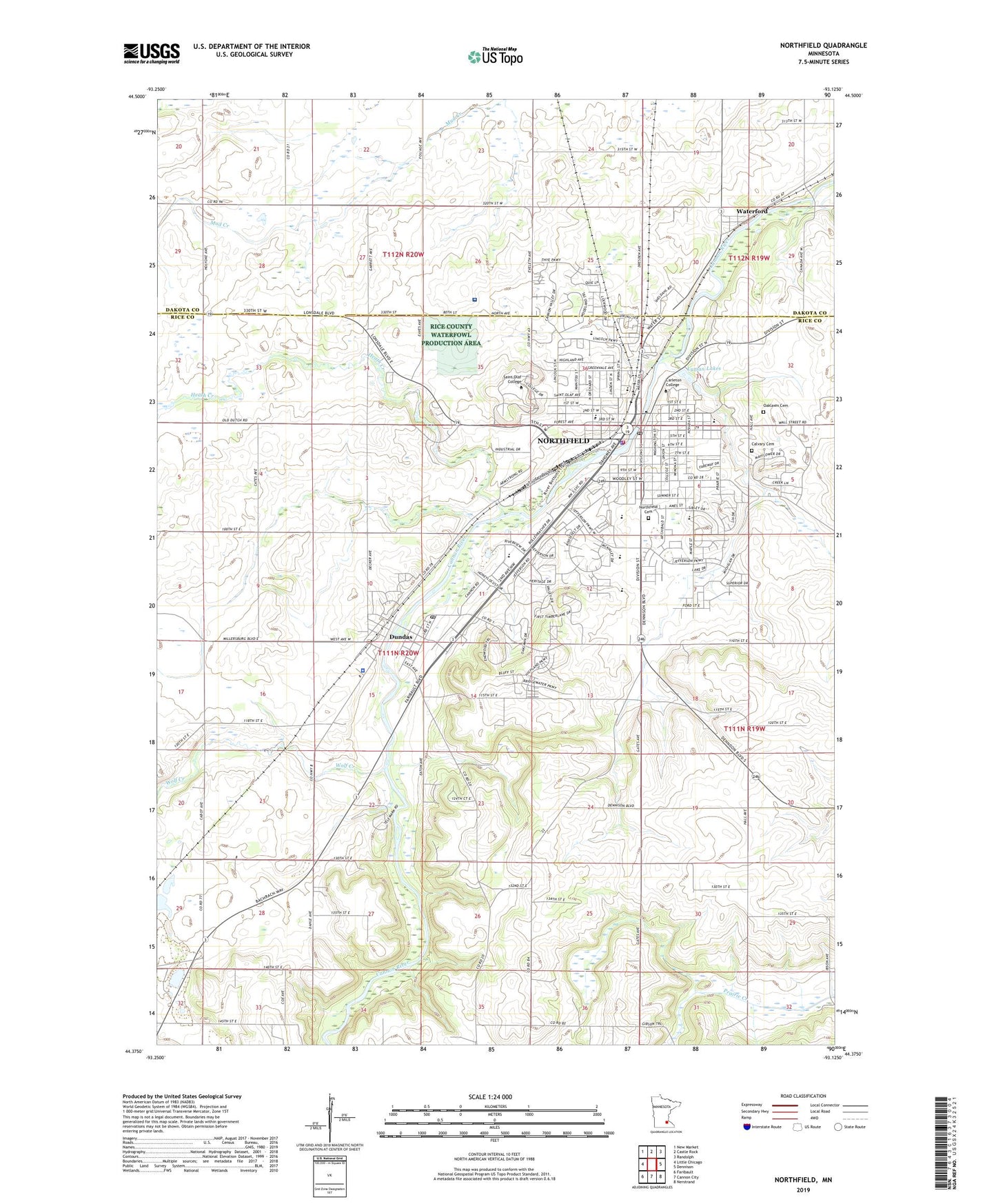
2022 topographic map quadrangle Northfield in the state of Minnesota. Scale: 1:24000. Based on the newly updated USGS 7.5' US Topo map series, this map is in the following counties: Rice, Dakota. The map contains contour data, water features, and other items you are used to seeing on USGS maps, but also has updated roads and other features. This is the next generation of topographic maps. Printed on high-quality waterproof paper with UV fade-resistant inks.
Quads adjacent to this one:
West: Little Chicago
Northwest: New Market
North: Castle Rock
Northeast: Randolph
East: Dennison
Southeast: Nerstrand
South: Cannon City
Southwest: Faribault
This map covers the same area as the classic USGS quad with code o44093d2.
Contains the following named places: Archibald Mill Historical Marker, Area Learning Center, Baker School, Bridgewater Elementary School, C G W Station, Calvary Cemetery, Cannon River Dam, Cannon River Reservoir, Carleton College, Central Park, City of Dundas, City of Northfield, Dundas, Dundas Police Department, Dundas Post Office, Greenvale Park Elementary School, Heath Creek, John North Park, KRLX-FM (Northfield), Laura Baker School, Little Prairie Church, Longfellow School, Lyman Lakes, Northfield, Northfield Carrier Annex Post Office, Northfield Cemetery, Northfield Fire and Rescue, Northfield High School, Northfield Hospital, Northfield Middle School, Northfield Police Dept, Northfield Post Office, Oaklawn Cemetery, Saint Dominic School, Saint Olaf College, Sibley Elementary School, Thomas Anderson Veblen and Kari Bunde Veblen Farmstead, Township of Bridgewater, Wade Park, Washington School, Waterford, Waterford Post Office, WCAL-AM (Northfield), WCAL-FM (Northfield), Wolf Creek, ZIP Codes: 55019, 55057