MyTopo
Medford East Minnesota US Topo Map
Couldn't load pickup availability
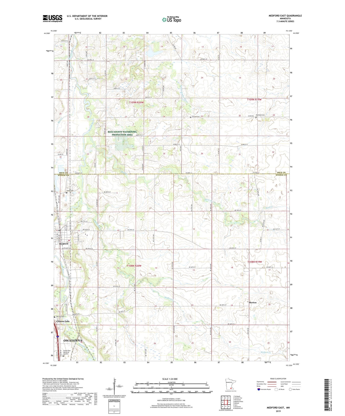
2022 topographic map quadrangle Medford East in the state of Minnesota. Scale: 1:24000. Based on the newly updated USGS 7.5' US Topo map series, this map is in the following counties: Steele, Rice. The map contains contour data, water features, and other items you are used to seeing on USGS maps, but also has updated roads and other features. This is the next generation of topographic maps. Printed on high-quality waterproof paper with UV fade-resistant inks.
Quads adjacent to this one:
West: Medford West
Northwest: Faribault
North: Cannon City
Northeast: Nerstrand
East: Moland
Southeast: Owatonna SE
South: Owatonna
Southwest: Saco
This map covers the same area as the classic USGS quad with code o44093b2.
Contains the following named places: Christ the King Church, City of Medford, Clinton Falls, Clinton Falls Post Office, Congregational United Church of Christ, County Ditch Number Eighteen, County Ditch Number Nineteen, Crane Creek, Eklund Cemetery, Grand View Memorial Gardens, Heritage Halls Transportation Museum, Medford, Medford City Hall, Medford Creek, Medford Fire Department, Medford Post Office, Medford Public School, Medford Trailer Park, Merton, Merton Post Office, Mud Creek, Oak Hill Cemetery, Perry School, Richland Cemetery, Rock School, Rush Creek, School Number 2086, Township of Clinton Falls, Township of Medford, Township of Walcott, Trinity Lutheran Church, Union Cemetery, Walcott, ZIP Code: 55049