MyTopo
Norseland Minnesota US Topo Map
Couldn't load pickup availability
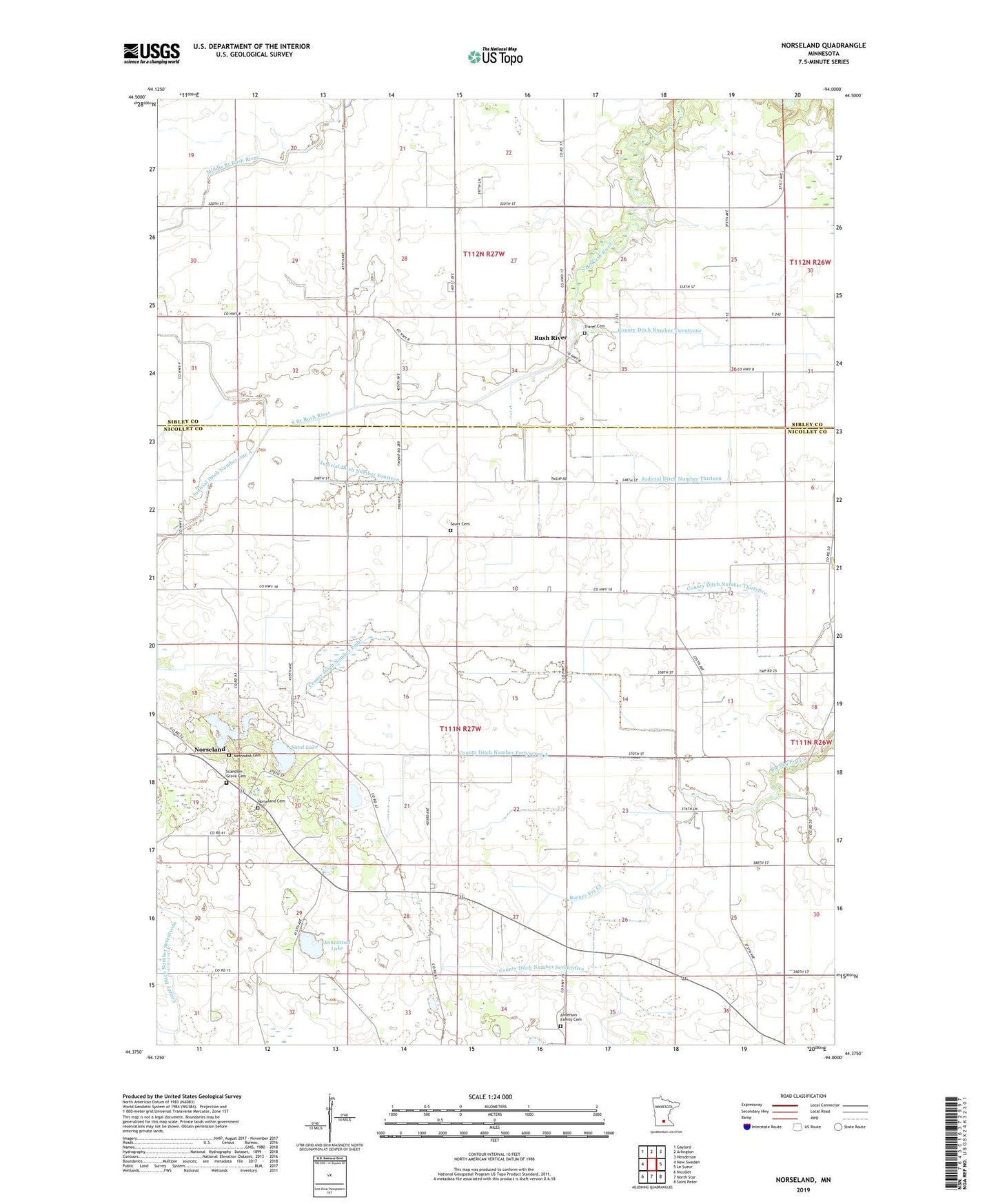
2022 topographic map quadrangle Norseland in the state of Minnesota. Scale: 1:24000. Based on the newly updated USGS 7.5' US Topo map series, this map is in the following counties: Nicollet, Sibley. The map contains contour data, water features, and other items you are used to seeing on USGS maps, but also has updated roads and other features. This is the next generation of topographic maps. Printed on high-quality waterproof paper with UV fade-resistant inks.
Quads adjacent to this one:
West: New Sweden
Northwest: Gaylord
North: Arlington
Northeast: Henderson
East: Le Sueur
Southeast: Saint Peter
South: North Star
Southwest: Nicollet
This map covers the same area as the classic USGS quad with code o44094d1.
Contains the following named places: Anderson Family Cemetery, Annexstad Lake, Camp Norseland, County Ditch Number Eight, County Ditch Number Fortyseven A, County Ditch Number Seventyfive, County Ditch Number Seventyone, County Ditch Number Thirtyfive, County Ditch Number Twentyone, Judicial Ditch Number Fourteen, Judicial Ditch Number Thirteen, Norseland, Norseland Cemetery, Norseland Church, Norseland Methodist Cemetery, Norseland Post Office, Norseland School, Rush River, Rush River Post Office, Sand Lake, Sauer Cemetery, Scandian Grove Cemetery, Township of Kelso, Township of Lake Prairie, Traver Cemetery