
MyTopo
Osakis Minnesota US Topo Map
Couldn't load pickup availability
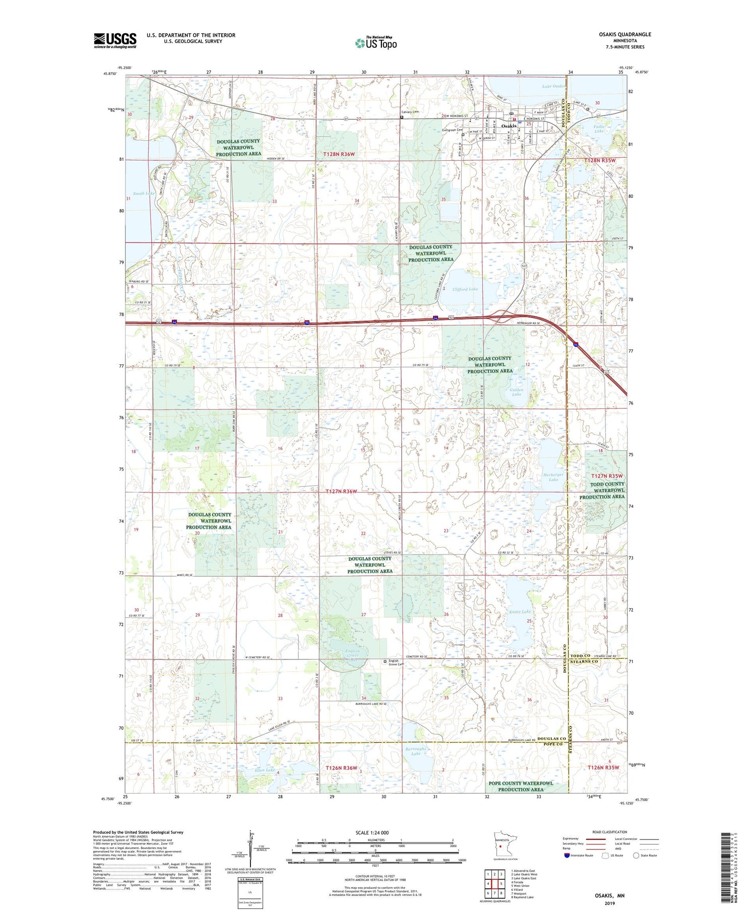
2019 topographic map quadrangle Osakis in the state of Minnesota. Scale: 1:24000. Based on the newly updated USGS 7.5' US Topo map series, this map is in the following counties: Douglas, Todd, Pope, Stearns. The map contains contour data, water features, and other items you are used to seeing on USGS maps, but also has updated roads and other features. This is the next generation of topographic maps. Printed on high-quality waterproof paper with UV fade-resistant inks.
Quads adjacent to this one:
West: Forada
Northwest: Alexandria East
North: Lake Osakis West
Northeast: Lake Osakis East
East: West Union
Southeast: Raymond Lake
South: Westport
Southwest: Villard
Contains the following named places: Burroughs Lake, Calvary Cemetery, City of Osakis, Clifford Lake, Community Memorial Home, Ellen Lake, English Grove Cemetery, English Grove Lake, Evergreen Cemetery, Faille Lake, Gulden Lake, Herberger Lake, Herberger Lake State Wildlife Management Are, Immaculate Conception Church, Kuntz Lake, Lakes Area Charter School, Lakeside Cemetery, Osagi Park, Osakis, Osakis Athletic Fields, Osakis City Hall, Osakis Fire Department, Osakis Lutheran Church, Osakis Medical Clinic, Osakis Police Department, Osakis Post Office, Osakis Public School, Osakis State Wildlife Management Area, Osakis Visitor Heritage Center, Osakis Wayside Park, Presbyterian Church, Redeemer Lutheran Church, Saint Agnes School, Smith Lake, Smith Lake Resort and Campground, Stage Station Historical Marker, Stevens Lake, Todd County Waterfowl Production Area, Township of Orange, United Methodist Church


