MyTopo
Pelican Lake Minnesota US Topo Map
Couldn't load pickup availability
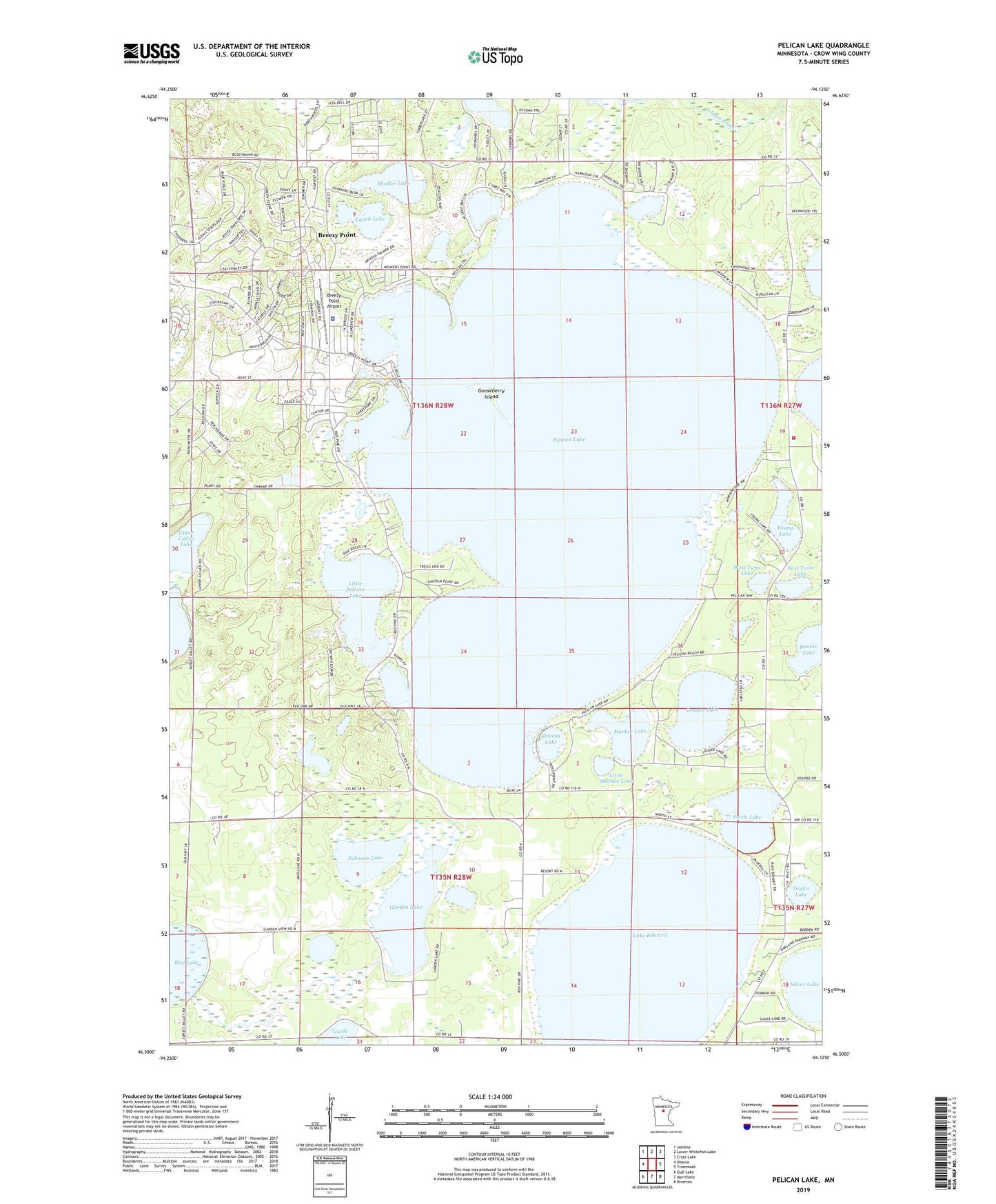
2019 topographic map quadrangle Pelican Lake in the state of Minnesota. Scale: 1:24000. Based on the newly updated USGS 7.5' US Topo map series, this map is in the following counties: Crow Wing. The map contains contour data, water features, and other items you are used to seeing on USGS maps, but also has updated roads and other features. This is the next generation of topographic maps. Printed on high-quality waterproof paper with UV fade-resistant inks.
Quads adjacent to this one:
West: Nisswa
Northwest: Jenkins
North: Lower Whitefish Lake
Northeast: Cross Lake
East: Trommald
Southeast: Riverton
South: Merrifield
Southwest: Gull Lake
Contains the following named places: Bonnie Lake, Breezy Point, Breezy Point Airport, Breezy Point Police Department, Breezy Point Post Office, City of Breezy Point, Deacon's Lodge Golf Club, East Twin Lake, Garden Lake, Gooseberry Island, Guida Lake, Johnson Lake, Lake Edward, Little Markee Lake, Little Pelican Lake, Lougee Lake, Lynch Lake, Markee Lake, Mission Township Fire Department - Station 1, Ossipee Post Office, Ossipee School, Pelican Lake, Pelican Lake Dam, Perch Lake, Rice Lake, Shaffer Lake, Shing Wako Resort and Campground, Silver Lake, Stevens Lake, Taylor Lake, Township of Lake Edward, Township of Pelican, Traditional Eighteen Hole Golf Course, West Twin Lake, Whitebirch Golf Course, Young Lake