MyTopo
Jenkins Minnesota US Topo Map
Couldn't load pickup availability
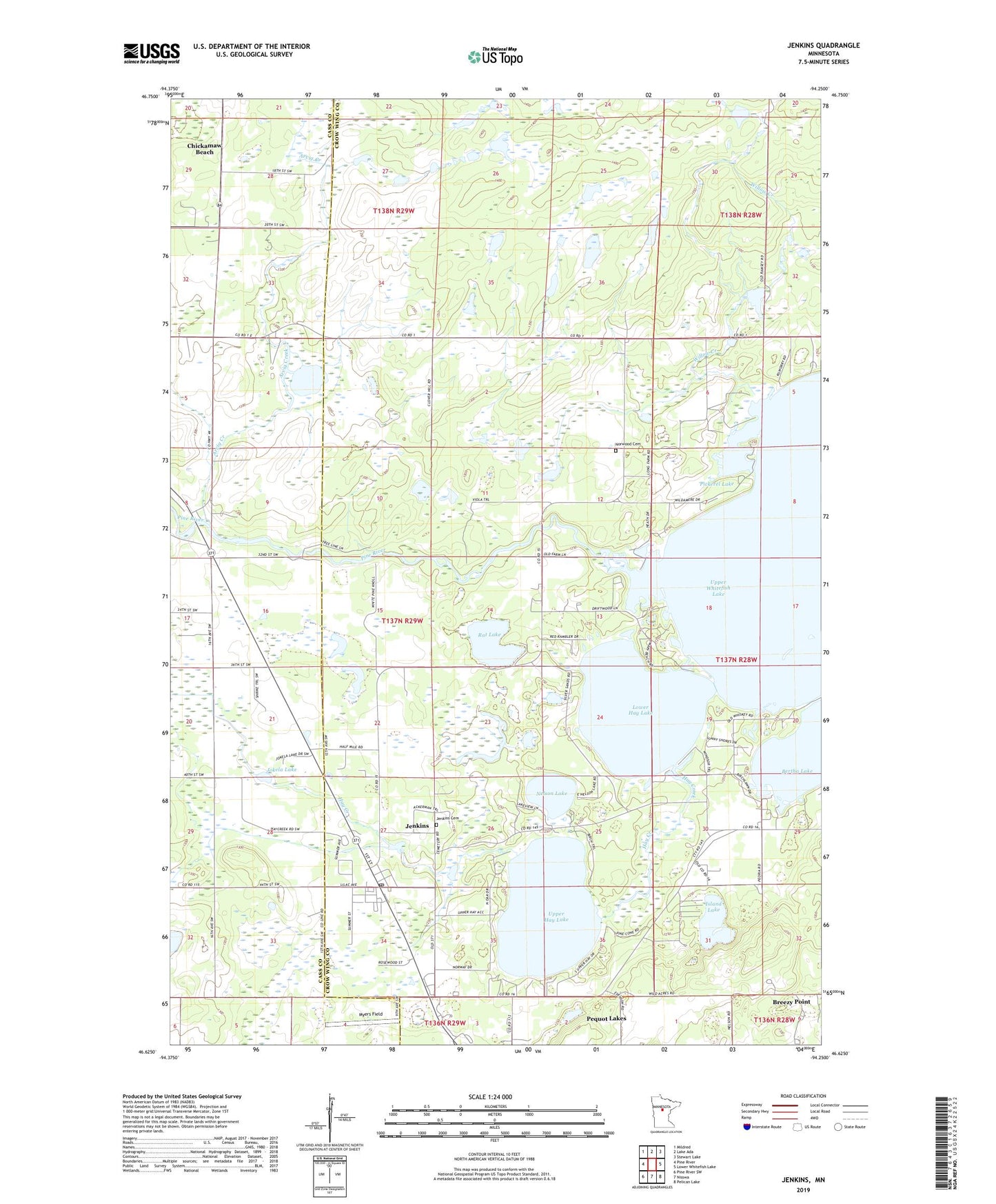
2022 topographic map quadrangle Jenkins in the state of Minnesota. Scale: 1:24000. Based on the newly updated USGS 7.5' US Topo map series, this map is in the following counties: Crow Wing, Cass. The map contains contour data, water features, and other items you are used to seeing on USGS maps, but also has updated roads and other features. This is the next generation of topographic maps. Printed on high-quality waterproof paper with UV fade-resistant inks.
Quads adjacent to this one:
West: Pine River
Northwest: Mildred
North: Lake Ada
Northeast: Stewart Lake
East: Lower Whitefish Lake
Southeast: Pelican Lake
South: Nisswa
Southwest: Pine River SW
This map covers the same area as the classic USGS quad with code o46094f3.
Contains the following named places: Arvig Creek, Bertha Lake, City of Jenkins, Clover Hill School, Driftwood Gift Shop and Museum, Driftwood Resort Golf Course, Hay Creek, Irish Hills Golf Course, Island Lake, Jenkins, Jenkins Cemetery, Jenkins Church of God, Jenkins Post Office, Jokela Lake, Lower Hay Lake, Myers Field, Nelson Lake, Norwood Cemetery, Rat Lake, River View RV Park, Township of Jenkins, Ultraflyte Incorporated Airport, Upper Hay Lake, Upper Whitefish Lake, Whitefish Gospel Tabernacle, Willow Creek, ZIP Code: 56456