MyTopo
Pengilly Minnesota US Topo Map
Couldn't load pickup availability
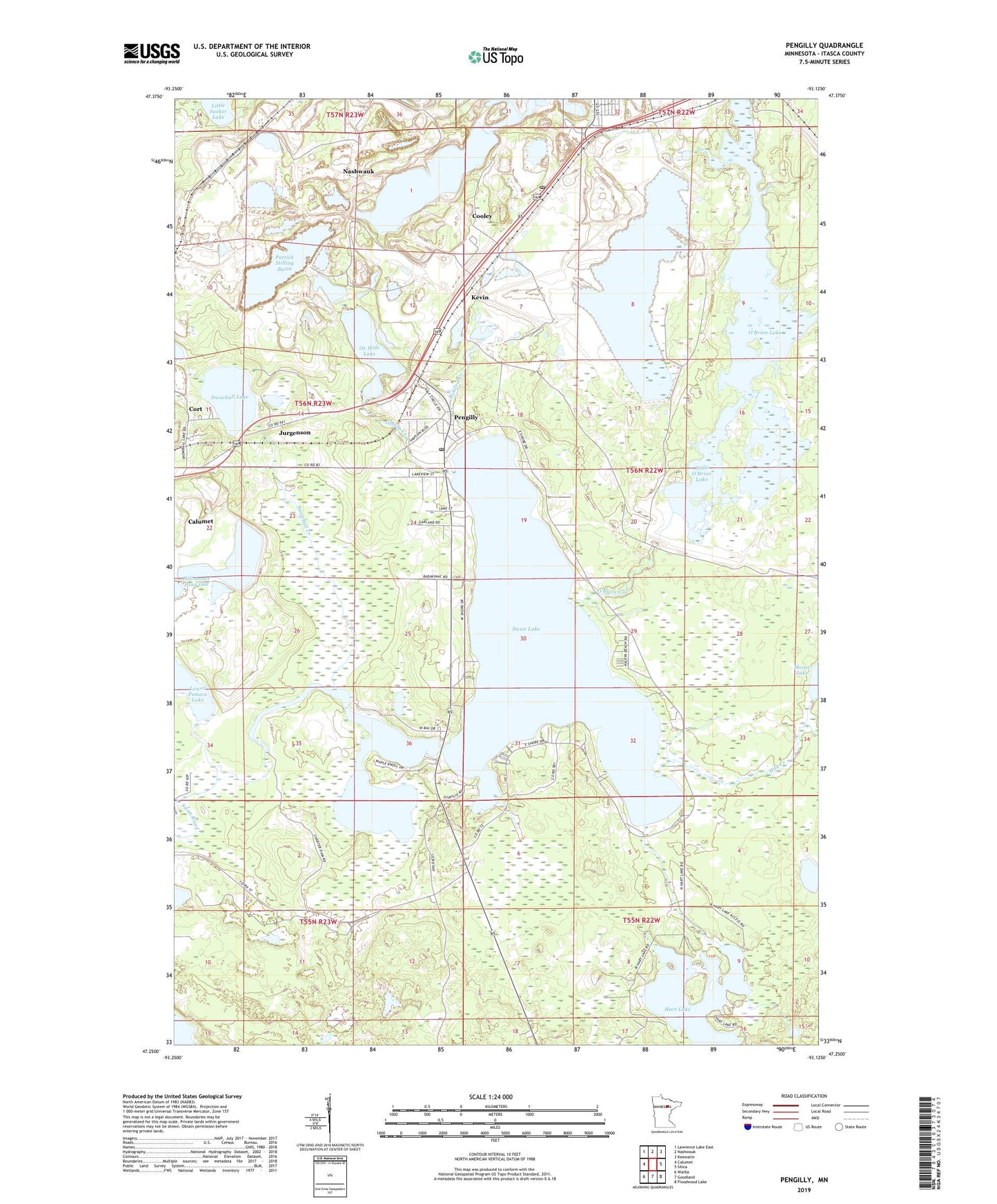
2019 topographic map quadrangle Pengilly in the state of Minnesota. Scale: 1:24000. Based on the newly updated USGS 7.5' US Topo map series, this map is in the following counties: Itasca. The map contains contour data, water features, and other items you are used to seeing on USGS maps, but also has updated roads and other features. This is the next generation of topographic maps. Printed on high-quality waterproof paper with UV fade-resistant inks.
Quads adjacent to this one:
West: Calumet
Northwest: Lawrence Lake East
North: Nashwauk
Northeast: Keewatin
East: Silica
Southeast: Floodwood Lake
South: Goodland
Southwest: Warba
Contains the following named places: Ann Mine, Butler Taconite Initial Tailings Dike, Butler Taconite Initial Tails BA, Calvary Baptist Church, Charter Dam, Cooley, Cooley Post Office, Cort, Cort Post Office, Crossroads Family Church, Draper Annex Mine, Harrison Mine, Hart Lake, Hay Creek, Helen Mine, Jurgenson, Kevin, Kevin Mine, Lammon Aid Lake, Langdom Mine, Little O'Brien Lake, Little Sucker Lake, Moose Lake, Nameless Lake, North Harrison Mine, O'Brien Creek, O'Brien Lake, Ox Hide Lake, Oxhide Creek, Patrick Annex Mine, Patrick Mine, Patrick Stilling Basin, Patrick Stilling Dike, Pengilly, Pengilly Post Office, Pickerel Creek, Snowball Creek, Snowball Lake, Snowball Lake Wayside Park, Snyder Mine, South Ann Mine, Sullivan Mine, Swan Lake, Swan Lake Campground, Swan Lake Country Club, Swan Lake Wayside Park, Township of Lone Pine, United Methodist Church, Welcome Creek, West Patrick Mine, ZIP Code: 55775