MyTopo
Phelps Minnesota US Topo Map
Couldn't load pickup availability
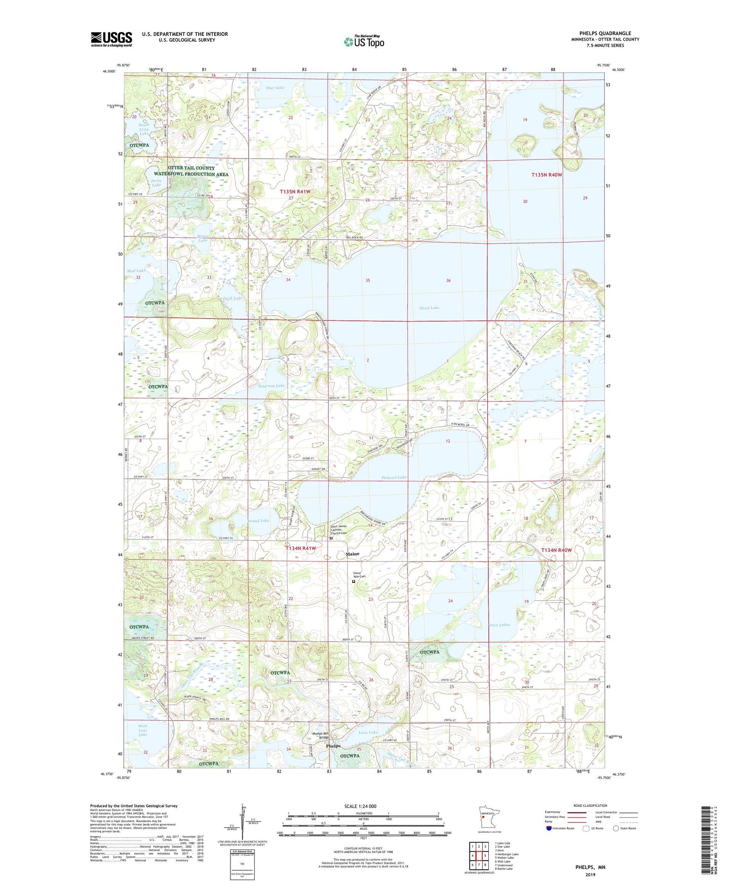
2019 topographic map quadrangle Phelps in the state of Minnesota. Scale: 1:24000. Based on the newly updated USGS 7.5' US Topo map series, this map is in the following counties: Otter Tail. The map contains contour data, water features, and other items you are used to seeing on USGS maps, but also has updated roads and other features. This is the next generation of topographic maps. Printed on high-quality waterproof paper with UV fade-resistant inks.
Quads adjacent to this one:
West: Heilberger Lake
Northwest: Lake Lida
North: Star Lake
Northeast: Dent
East: Walker Lake
Southeast: Battle Lake
South: Underwood
Southwest: Wall Lake
Contains the following named places: Amor Lake, Amor State Wildlife Management Area, Berkey Post Office, Dead Lake, Duck Lake, Leon Lake, Maine, Maine Church, Maine Post Office, Maria Lake, Monitor Falls Post Office, Mud Lake, Otter Tail River Dam, Otter Tail River Reservoir, Peterson Lake, Phelps, Phelps Mill Bridge, Phelps Post Office, Pickerel Lake, Round Lake, Saint James Catholic Church Cemetery, Saint James Church, School Number 129, School Number 137, School Number 22, School Number 241, School Number 251, Sharp Lake, Silent Vale Cemetery, South Long Lake, Star Lake Chapel, Star Lake Post Office, Township of Maine, Township of Star Lake, Twin Lakes, Zorns Lake