MyTopo
Walker Lake Minnesota US Topo Map
Couldn't load pickup availability
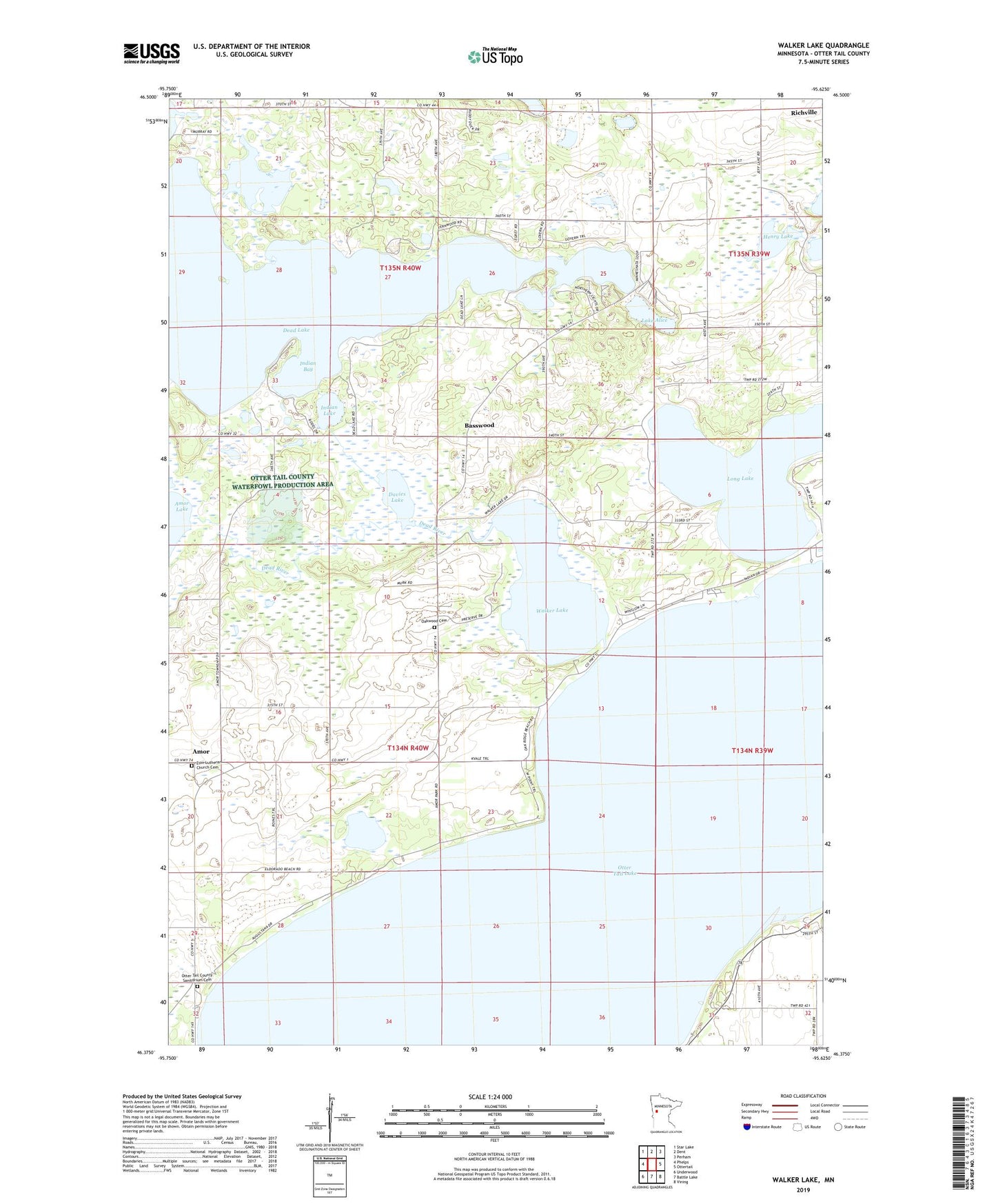
2022 topographic map quadrangle Walker Lake in the state of Minnesota. Scale: 1:24000. Based on the newly updated USGS 7.5' US Topo map series, this map is in the following counties: Otter Tail. The map contains contour data, water features, and other items you are used to seeing on USGS maps, but also has updated roads and other features. This is the next generation of topographic maps. Printed on high-quality waterproof paper with UV fade-resistant inks.
Quads adjacent to this one:
West: Phelps
Northwest: Star Lake
North: Dent
Northeast: Perham
East: Ottertail
Southeast: Vining
South: Battle Lake
Southwest: Underwood
This map covers the same area as the classic USGS quad with code o46095d6.
Contains the following named places: Amor, Amor Park, Amor Post Office, Basswood, Basswood Post Office, Basswood Seventh Day Adventist Church, Camp Nidaros, Craigie Flour Mill Historical Marker, Davies Lake, Davies State Wildlife Management Area, Dead Lake, Dead Lake East Dam, Dead Lake Park, Dead Lake State Wildlife Management Area, Dead River, Henry Lake, Indian Bay, Indian Lake, Lake Alice, Long Lake, Oakwood Cemetery, Otter Tail County, Otter Tail County Sanitorium Cemetery, Otter Tail Lake, Otter Tail Lake Campground, Otter Tail Nursing Home, Red Lantern Resort and Campground, School Number 104, School Number 131, School Number 170, School Number 239, School Number 240, School Number 256, School Number 267, Township of Amor, Township of Dead Lake, Vida Post Office, Walker Lake, Zion Lutheran Church, Zion Lutheran Church Cemetery, ZIP Code: 56576