
MyTopo
Princeton Minnesota US Topo Map
Couldn't load pickup availability
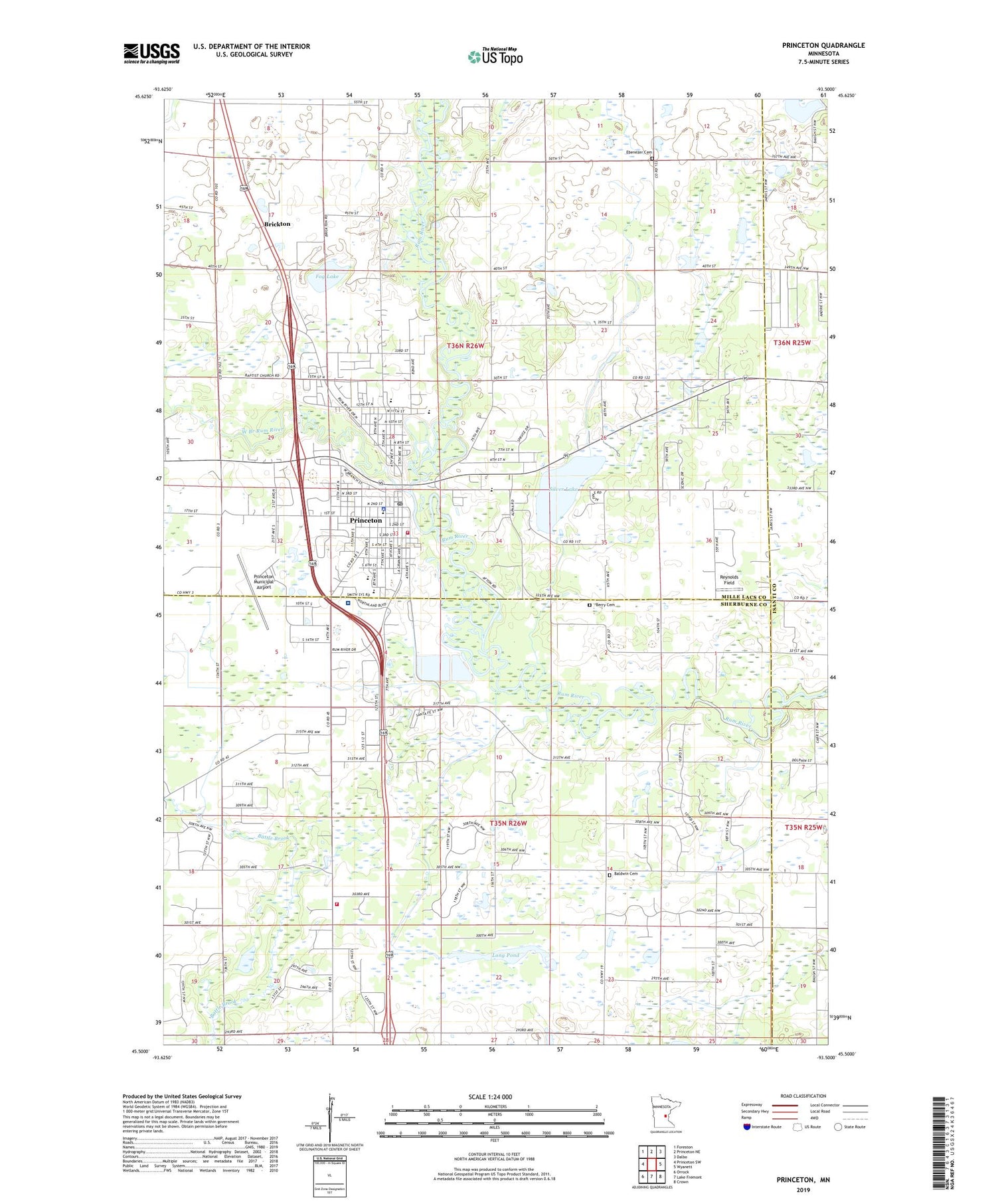
2019 topographic map quadrangle Princeton in the state of Minnesota. Scale: 1:24000. Based on the newly updated USGS 7.5' US Topo map series, this map is in the following counties: Mille Lacs, Sherburne, Isanti. The map contains contour data, water features, and other items you are used to seeing on USGS maps, but also has updated roads and other features. This is the next generation of topographic maps. Printed on high-quality waterproof paper with UV fade-resistant inks.
Quads adjacent to this one:
West: Princeton SW
Northwest: Foreston
North: Princeton NE
Northeast: Dalbo
East: Wyanett
Southeast: Crown
South: Lake Fremont
Southwest: Orrock
Contains the following named places: Baldwin Cemetery, Berry Cemetery, Brickton, City of Princeton, County Ditch Number Eighteen, County Ditch Number Four, County Ditch Number Twelve, Ebenezer German Methodist Cemetery, Fairview Northland Clinic, Fairview Northland Medical Center, Fog Lake, J Q Fruit Farm, Lake Margritte, Long Pond, North Memorial Health Air Care, North Memorial Health Ambulance - Princeton Region, Northeast Sherburne Fire and Rescue Department, Oak Knoll Cemetery, Princeton, Princeton Evangelical Free Church, Princeton Fire and Rescue, Princeton Municipal Airport, Princeton Police Department, Princeton Post Office, Reynolds Field, Rum River Golf Club, Sherburne Country Mobile Home Park, Silver Lake, Township of Baldwin, Township of Princeton, West Branch Rum River, WQPM-AM (Princeton), WQPM-FM (Princeton), ZIP Code: 55371


