MyTopo
Red Lake Falls Minnesota US Topo Map
Couldn't load pickup availability
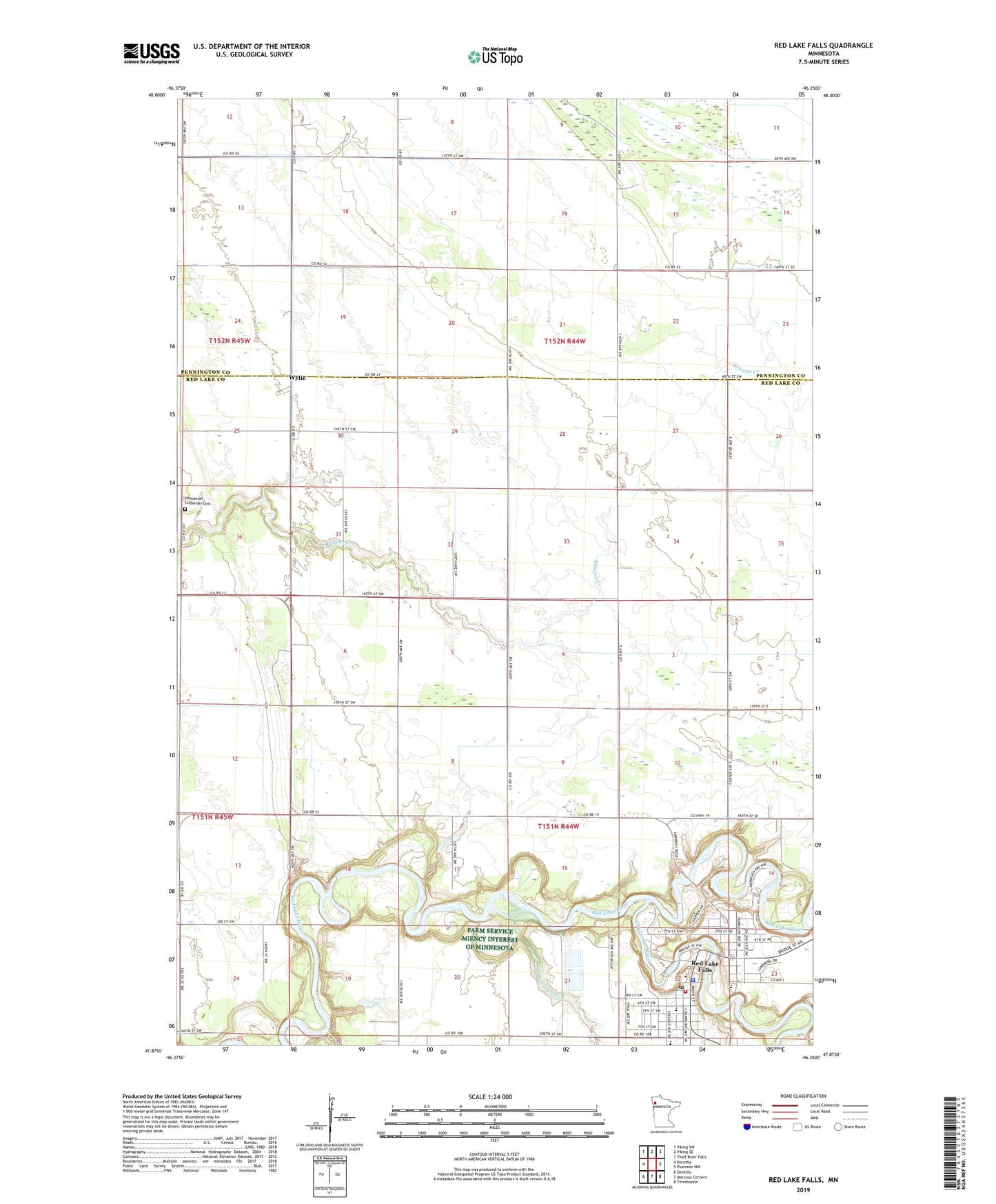
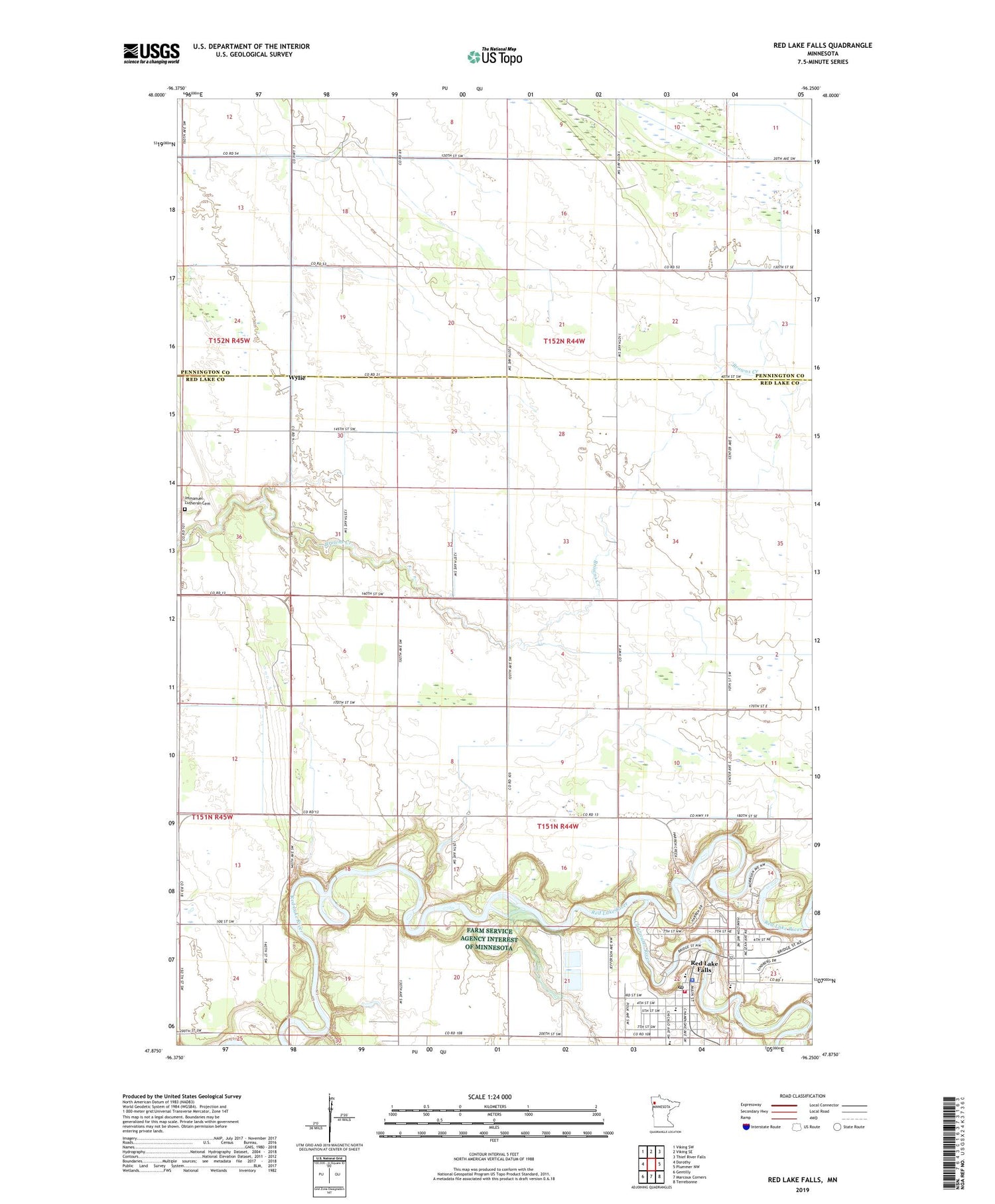
2019 topographic map quadrangle Red Lake Falls in the state of Minnesota. Scale: 1:24000. Based on the newly updated USGS 7.5' US Topo map series, this map is in the following counties: Red Lake, Pennington. The map contains contour data, water features, and other items you are used to seeing on USGS maps, but also has updated roads and other features. This is the next generation of topographic maps. Printed on high-quality waterproof paper with UV fade-resistant inks.
Quads adjacent to this one:
West: Dorothy
Northwest: Viking SW
North: Viking SE
Northeast: Thief River Falls
East: Plummer NW
Southeast: Terrebonne
South: Marcoux Corners
Southwest: Gentilly
Contains the following named places: Altru Clinic - Red Lake Falls, Bethany Lutheran Church, City of Red Lake Falls, Clearwater River, County Ditch Number Sixtynine, County Ditch Number Twelve, Evangelical Church, Higinbotham State Wildlife Management Area, Hillcrest Nursing Home, Hilltop, Hughes Elementary School, Immanuel Lutheran Cemetery, Jahnke School, Lafayette High School, Oak Knoll Golf Course, Oaks Mobile Home Park, Presbyterian Church, Red Lake County Courthouse, Red Lake County Fairgrounds, Red Lake County Sheriff's Office, Red Lake Falls, Red Lake Falls Post Office, Red Lake Falls Public Library, Red Lake Falls Railroad Station, Red Lake Falls Volunteer Ambulance, Red Lake Falls Volunteer Fire Department, Redeemer Lutheran Church, Riverside Park, Riverside Park Campground, Saint John's Lutheran Church, Saint Joseph's Church, Saint Joseph's School, Sportsman Park, Township of Black River, Township of Browns Creek, Township of Red Lake Falls, Voyageurs View Campground, Washington School, Wylie, Wylie Post Office, ZIP Code: 56750