MyTopo
Plummer NW Minnesota US Topo Map
Couldn't load pickup availability
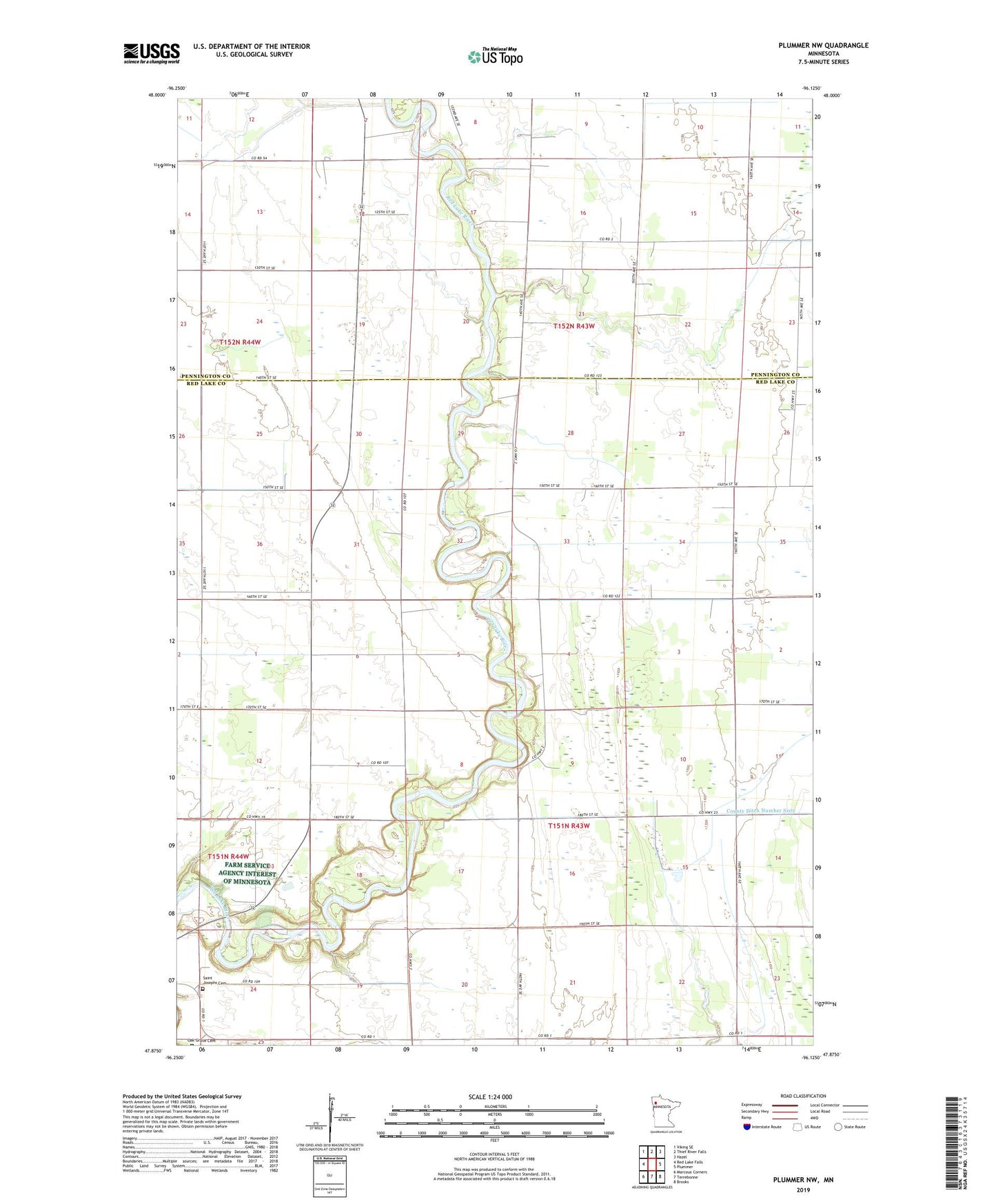
2022 topographic map quadrangle Plummer NW in the state of Minnesota. Scale: 1:24000. Based on the newly updated USGS 7.5' US Topo map series, this map is in the following counties: Red Lake, Pennington. The map contains contour data, water features, and other items you are used to seeing on USGS maps, but also has updated roads and other features. This is the next generation of topographic maps. Printed on high-quality waterproof paper with UV fade-resistant inks.
Quads adjacent to this one:
West: Red Lake Falls
Northwest: Viking SE
North: Thief River Falls
Northeast: Hazel
East: Plummer
Southeast: Brooks
South: Terrebonne
Southwest: Marcoux Corners
This map covers the same area as the classic USGS quad with code o47096h2.
Contains the following named places: County Ditch Number Seventysix, County Ditch Number Sixty, County Ditch Number Sixtytwo, County Ditch Number Thirteen, County Ditch Number Twentyeight, County Ditch Number Twentyfour, County Ditch Number Twentythree, Saint Josephs Cemetery, Township of Gervais, Township of River, Township of River Falls, ZIP Code: 56754