
MyTopo
Red Lake OE N Minnesota US Topo Map
Couldn't load pickup availability
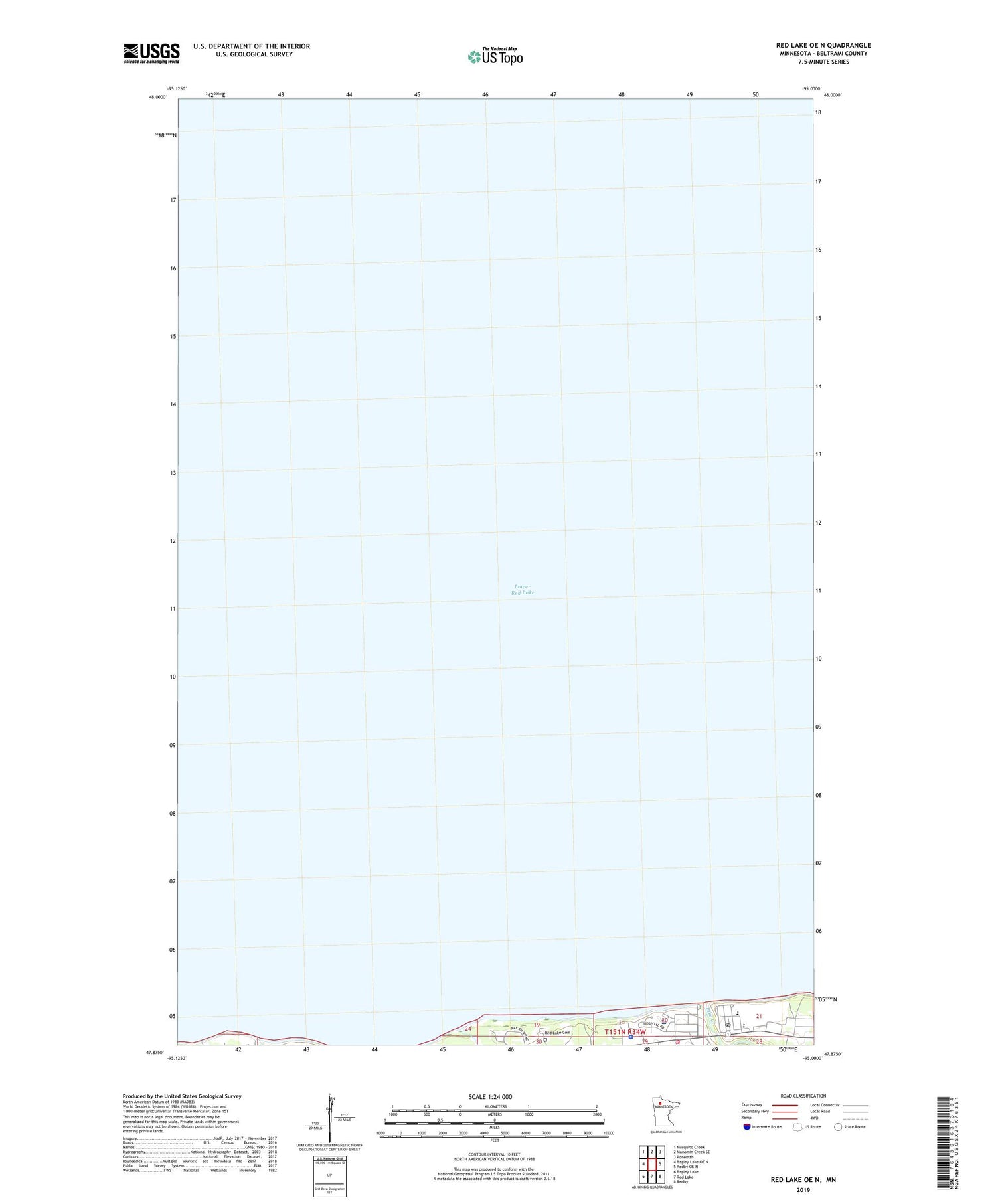
2019 topographic map quadrangle Red Lake OE N in the state of Minnesota. Scale: 1:24000. Based on the newly updated USGS 7.5' US Topo map series, this map is in the following counties: Beltrami. The map contains contour data, water features, and other items you are used to seeing on USGS maps, but also has updated roads and other features. This is the next generation of topographic maps. Printed on high-quality waterproof paper with UV fade-resistant inks.
Quads adjacent to this one:
West: Bagley Lake OE N
Northwest: Mosquito Creek
North: Manomin Creek SE
Northeast: Ponemah
East: Redby OE N
Southeast: Redby
South: Red Lake
Southwest: Bagley Lake
Contains the following named places: Little Rock Creek, Lower Red Lake, Pike Creek, Point Creek, Red Lake, Red Lake Cemetery, Red Lake Fire Department, Red Lake Indian Health Service Hospital, Red Lake Police Department, Redlake High School, Redlake Post Office, Saint Mary's Mission, Saint Mary's Mission School


