MyTopo
Redby Minnesota US Topo Map
Couldn't load pickup availability
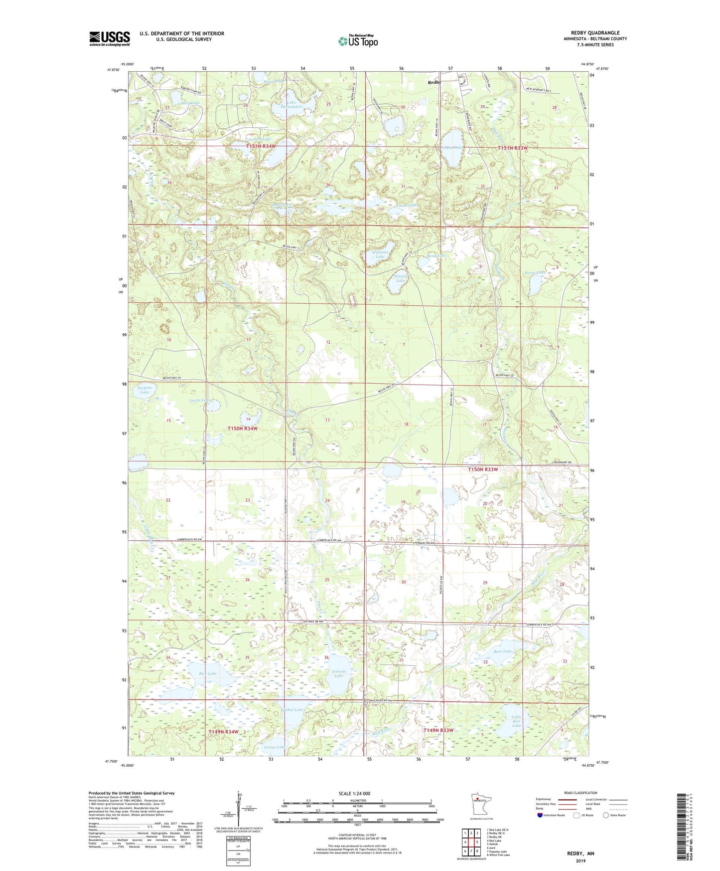
2022 topographic map quadrangle Redby in the state of Minnesota. Scale: 1:24000. Based on the newly updated USGS 7.5' US Topo map series, this map is in the following counties: Beltrami. The map contains contour data, water features, and other items you are used to seeing on USGS maps, but also has updated roads and other features. This is the next generation of topographic maps. Printed on high-quality waterproof paper with UV fade-resistant inks.
Quads adjacent to this one:
West: Red Lake
Northwest: Red Lake OE N
North: Redby OE N
Northeast: Redby NE
East: Nebish
Southeast: White Fish Lake
South: Puposky Lake
Southwest: Aure
This map covers the same area as the classic USGS quad with code o47094g8.
Contains the following named places: Balif Lake, Bass Lake, Bond Lake, Burns Lake, Chain Lake, Colombo Lake, Dickens Lake, Fahul Lake, Green Lake, Grenn Lake, Heart Lake, Kinney Lake, Lake Emerald, Lake Shemahgun, Leslin Lake, Little Rice Lake, Mud Lake, Mud River Lookout Tower, Pleasant Valley Church, Pleasant Valley School, Redby Census Designated Place, Rice Lake, Sells Lake, Smith Lake, Tenmile Lake, Williams Lake