MyTopo
Renville Minnesota US Topo Map
Couldn't load pickup availability
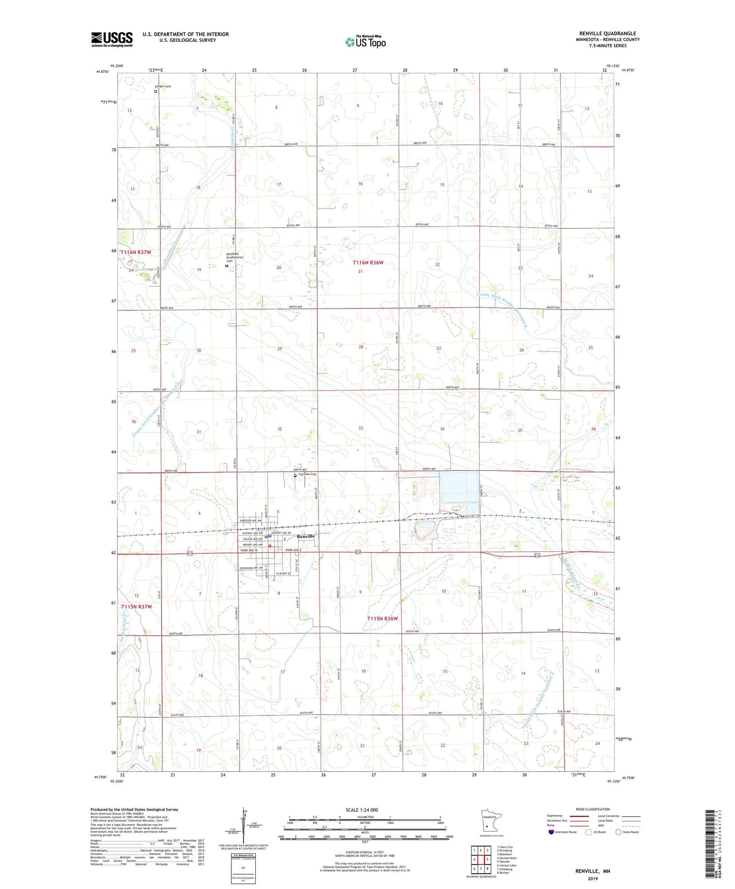
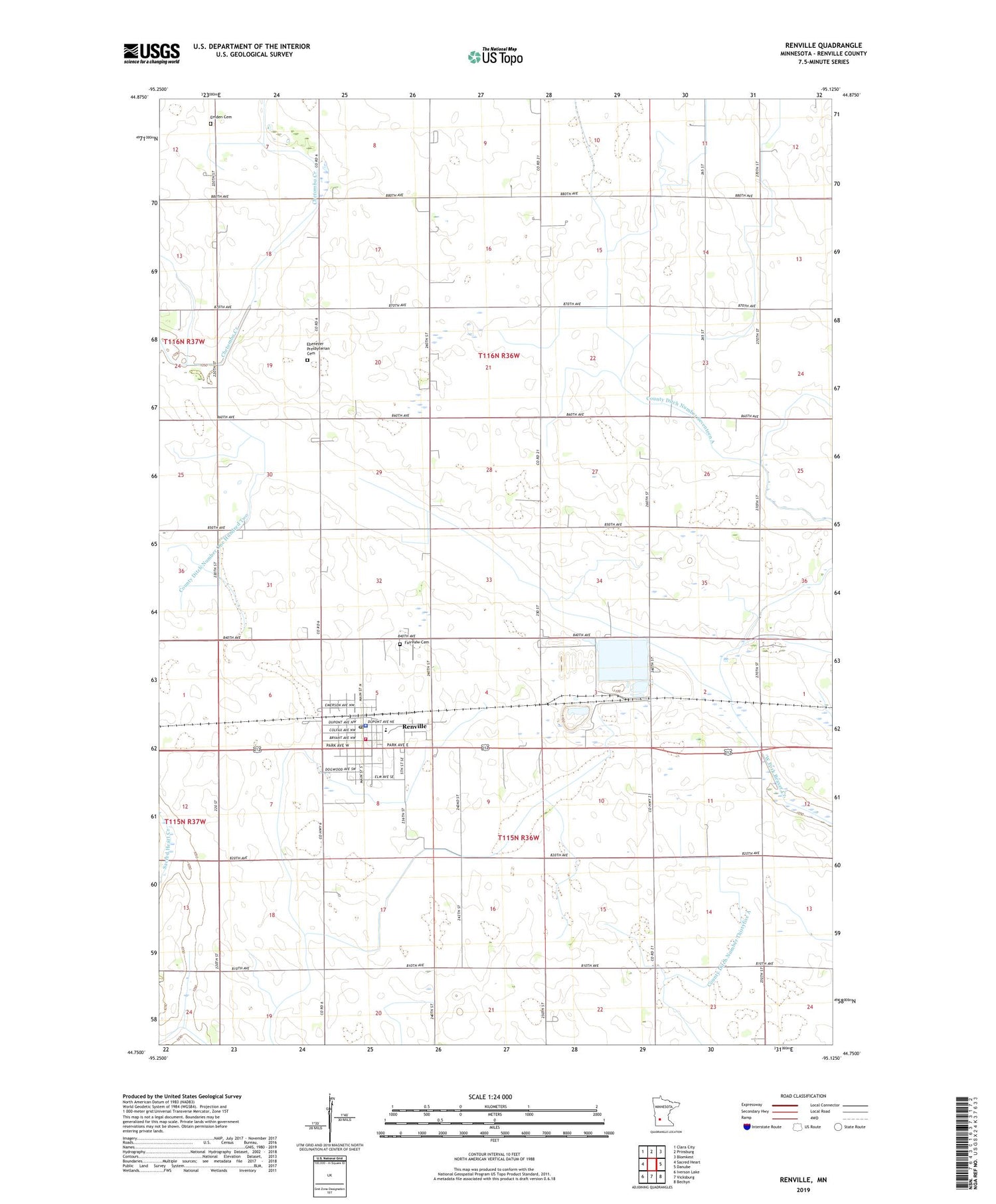
2019 topographic map quadrangle Renville in the state of Minnesota. Scale: 1:24000. Based on the newly updated USGS 7.5' US Topo map series, this map is in the following counties: Renville. The map contains contour data, water features, and other items you are used to seeing on USGS maps, but also has updated roads and other features. This is the next generation of topographic maps. Printed on high-quality waterproof paper with UV fade-resistant inks.
Quads adjacent to this one:
West: Sacred Heart
Northwest: Clara City
North: Prinsburg
Northeast: Blomkest
East: Danube
Southeast: Bechyn
South: Vicksburg
Southwest: Iverson Lake
Contains the following named places: City of Renville, County Ditch Number Fortyfive, County Ditch Number One Hundred Seven, County Ditch Number One Hundred Two, County Ditch Number Seventeen A, County Ditch Number Thirtyfive A, County Ditch Number Thirtynine, County Ditch Number Thirtyseven, Ebenezer Church, Ebenezer Presbyterian Cemetery, Emden Cemetery, Emden Christian Reformed Church, Fairview Cemetery, First Lutheran Church, Holy Redeemer Church, Prairie Family Practice Center, Ren Villa Nursing Home, Renville, Renville Ambulance Service, Renville City Hall, Renville City Library, Renville Fire Department, Renville Police Department, Renville Post Office, Renville Public School, Saint John's Lutheran Church, Township of Crooks, Township of Emmet, United Methodist Church, ZIP Code: 56284