MyTopo
Clara City Minnesota US Topo Map
Couldn't load pickup availability
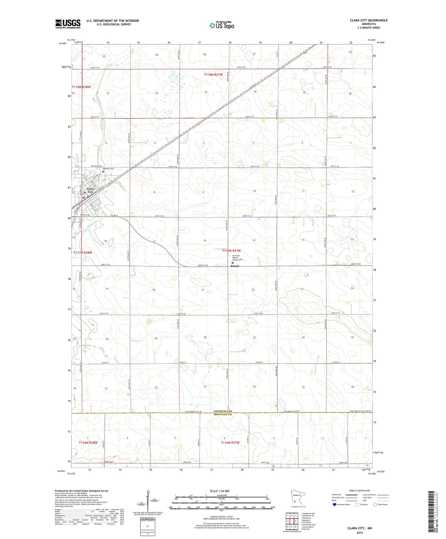
2022 topographic map quadrangle Clara City in the state of Minnesota. Scale: 1:24000. Based on the newly updated USGS 7.5' US Topo map series, this map is in the following counties: Chippewa, Renville. The map contains contour data, water features, and other items you are used to seeing on USGS maps, but also has updated roads and other features. This is the next generation of topographic maps. Printed on high-quality waterproof paper with UV fade-resistant inks.
Quads adjacent to this one:
West: Maynard
Northwest: Kerkhoven SW
North: Kerkhoven SE
Northeast: Raymond
East: Prinsburg
Southeast: Renville
South: Sacred Heart
Southwest: Minnesota Falls
This map covers the same area as the classic USGS quad with code o44095h3.
Contains the following named places: Bethany Reformed Cemetery, Bethany Reformed Church, Bunde, Bunde Christian Reformed Church, Christian Reform Church Cemetery, City of Clara City, Clara City, Clara City Clinic, Clara City Fire Department, Clara City Hall, Clara City Nursing Home, Clara City Police Department, Clara City Post Office, Clara City Public Library, County Ditch Number Fiftytwo, Faith Lutheran Church, Immanuel Lutheran Church, Judicial Ditch Number Two, MacCray High School, MacCray Junior High School, Saint Clara Catholic Church, Township of Rheiderland, ZIP Code: 56222