MyTopo
Sacred Heart Minnesota US Topo Map
Couldn't load pickup availability
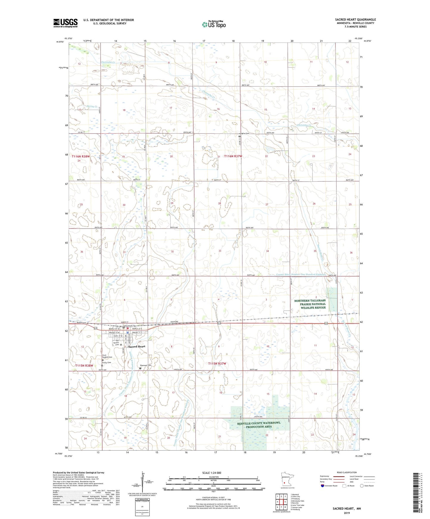
2022 topographic map quadrangle Sacred Heart in the state of Minnesota. Scale: 1:24000. Based on the newly updated USGS 7.5' US Topo map series, this map is in the following counties: Renville. The map contains contour data, water features, and other items you are used to seeing on USGS maps, but also has updated roads and other features. This is the next generation of topographic maps. Printed on high-quality waterproof paper with UV fade-resistant inks.
Quads adjacent to this one:
West: Minnesota Falls
Northwest: Maynard
North: Clara City
Northeast: Prinsburg
East: Renville
Southeast: Vicksburg
South: Iverson Lake
Southwest: Lone Tree Lake
This map covers the same area as the classic USGS quad with code o44095g3.
Contains the following named places: City of Sacred Heart, County Ditch Number Fortysix, County Ditch Number One Hundred Eighteen, County Ditch Number One Hundred Nineteen, County Ditch Number One Hundred Sixteen, County Ditch Number One Hundred Thirtyeight, Dustrud and Lanning Cemetery, Dysband State Wildlife Managaement Area, Ebenezer Cemetery, First English Cemetery, First English Lutheran Church, Judicial Ditch Number Eight, Krogfus Cemetery, Our Saviors Cemetery, Our Saviors Lutheran Church, Renville County Waterfowl Production Area, Renville County West Schools, Sacred Heart, Sacred Heart Fire Department, Sacred Heart Police Department, Sacred Heart Post Office, Township of Ericson, Trinity Cemetery, ZIP Code: 56285