MyTopo
Riverton Minnesota US Topo Map
Couldn't load pickup availability
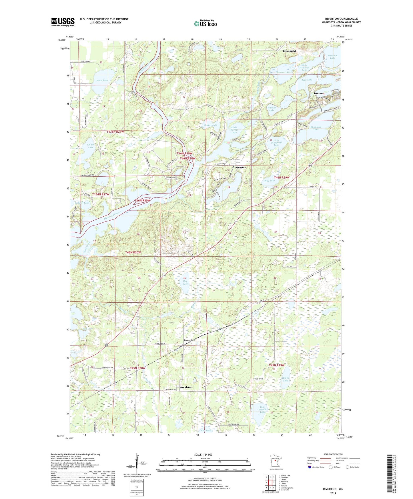
2019 topographic map quadrangle Riverton in the state of Minnesota. Scale: 1:24000. Based on the newly updated USGS 7.5' US Topo map series, this map is in the following counties: Crow Wing. The map contains contour data, water features, and other items you are used to seeing on USGS maps, but also has updated roads and other features. This is the next generation of topographic maps. Printed on high-quality waterproof paper with UV fade-resistant inks.
Quads adjacent to this one:
West: Merrifield
Northwest: Pelican Lake
North: Trommald
Northeast: Cuyuna
East: Crosby
Southeast: Grave Lake
South: South Long Lake
Southwest: Brainerd
Contains the following named places: Alstead Mine, Arco Mine, Blackhoof Lake, Carlson Mine, City of Riverton, Crow Wing County, Fawn Lake, Hay Creek, Hay Lake, Homecroft, Hoppy Lake, Horseshoe Lake, Huntington Mine, Ironton Creek, June Lake, Little Blackhoof Lake, Little Menomin Lake, Little Rabbit Lake, Loerch, Loerch Post Office, Loerch State Wildlife Management Area, Mahnomen Number Two Mine, Mallen Mine, Mud Lake, Pascoe Lake, Pascoe Lake Dam, Portage Lake, Rabbit River, Riverton, Riverton Post Office, Rowe Mine, Sagamore Mine, Sand Creek, Section Six Mine, Silver Lake School, Snoshoe Mine, Spider Lake, Spruce Lake, Township of Center, Township of Irondale, Township of Oak Lawn, Twin Island Lake, Virginia Mine, Woodrow, Woodrow Post Office, Woods Post Office, ZIP Code: 56455