MyTopo
South Long Lake Minnesota US Topo Map
Couldn't load pickup availability
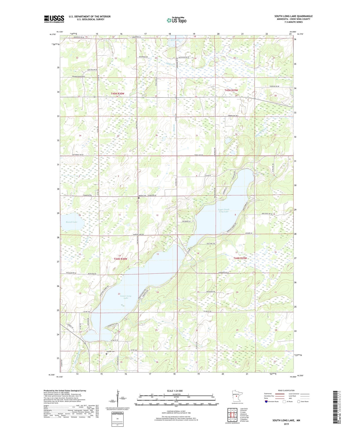
2022 topographic map quadrangle South Long Lake in the state of Minnesota. Scale: 1:24000. Based on the newly updated USGS 7.5' US Topo map series, this map is in the following counties: Crow Wing. The map contains contour data, water features, and other items you are used to seeing on USGS maps, but also has updated roads and other features. This is the next generation of topographic maps. Printed on high-quality waterproof paper with UV fade-resistant inks.
Quads adjacent to this one:
West: Brainerd
Northwest: Merrifield
North: Riverton
Northeast: Crosby
East: Grave Lake
Southeast: Platte Lake
South: Shephard
Southwest: Lastrup NW
This map covers the same area as the classic USGS quad with code o46094c1.
Contains the following named places: Bethel Church, Bethel Lutheran Cemetery, Hay Creek, Hillside Cemetery, Long Lake Upper Dam, Lower Long Lake, Lower Long Lake Dam, Mud Lake, Russell Lake, South Long Lake, South Long Lake Church, Upper South Long Lake