MyTopo
Rochert Minnesota US Topo Map
Couldn't load pickup availability
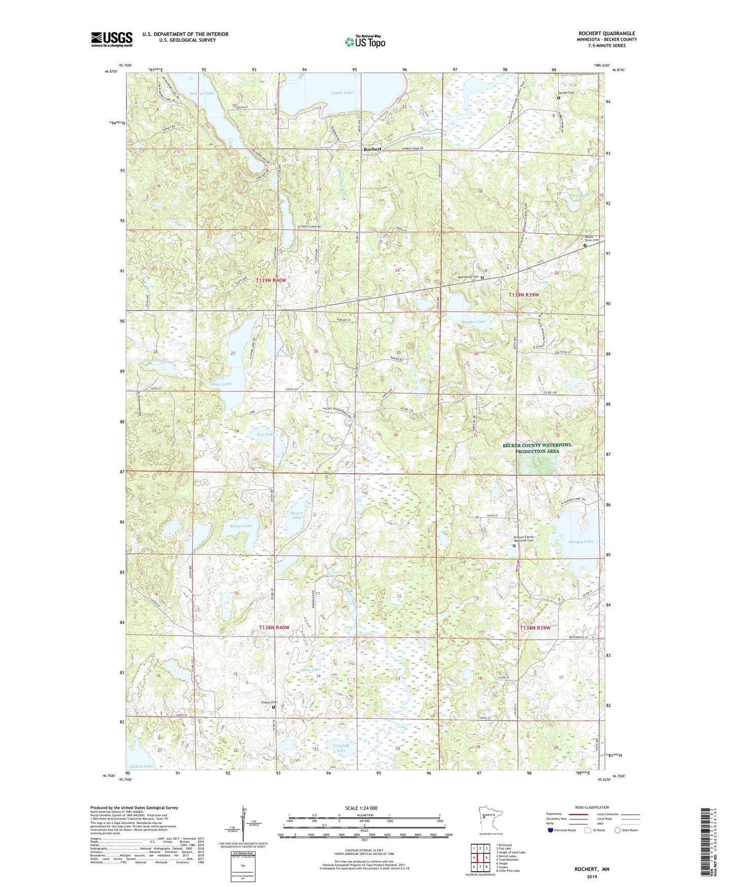
2019 topographic map quadrangle Rochert in the state of Minnesota. Scale: 1:24000. Based on the newly updated USGS 7.5' US Topo map series, this map is in the following counties: Becker. The map contains contour data, water features, and other items you are used to seeing on USGS maps, but also has updated roads and other features. This is the next generation of topographic maps. Printed on high-quality waterproof paper with UV fade-resistant inks.
Quads adjacent to this one:
West: Detroit Lakes
Northwest: Richwood
North: Flat Lake
Northeast: Height of Land Lake
East: Toad Mountain
Southeast: Little Pine Lake
South: Frazee
Southwest: Vergas
Contains the following named places: Alvin Lake, Big Rock Lake, Chilton Cemetery, Chilton Lake, Chilton School, Cotton Lake Diversion Dam, Dretsch Family Memorial Cemetery, Elbow Lake, Fox Lake, Howe Lake, Hubbel Pond, Hubbel Pond Dam, Hubbel Pond Game Refuge, Hungry Lake, Irish Lake, Jones Lake, Lake Region Church, Mennonite Cemetery, Mount Olive Cemetery, Neuner Lake, Pearce Lake, Perch Lake, Pickerel Lake, Pinewood Chapel, Rice Lake, Riverside School, Riverview Terrace Mobile Home Park, Rochert, Rochert Post Office, School Number 51, Senjen Cemetery, Township of Burlington, Township of Erie, Trieglaff Lake, Wettles Lake