
MyTopo
Rollag Minnesota US Topo Map
Couldn't load pickup availability
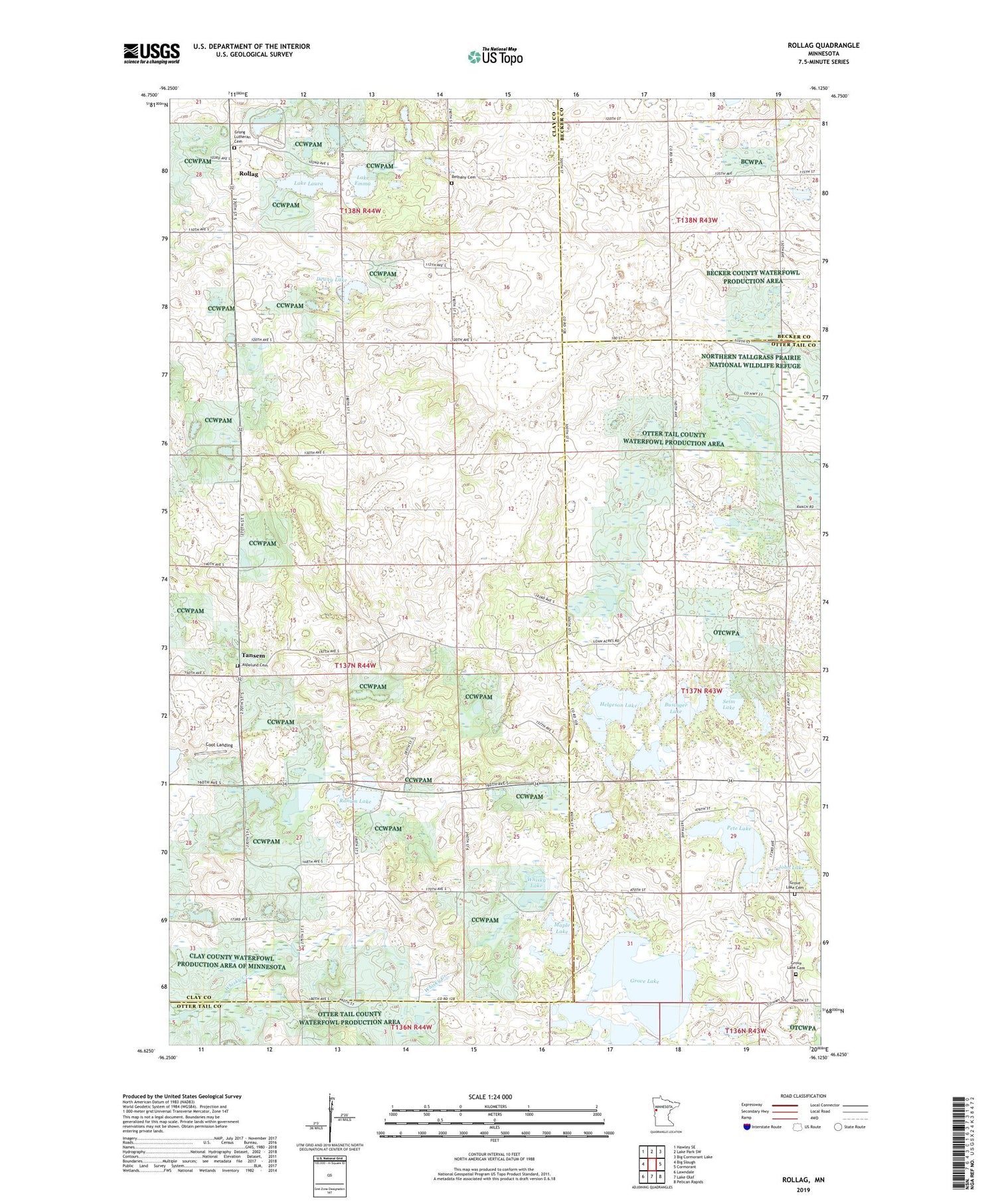
2019 topographic map quadrangle Rollag in the state of Minnesota. Scale: 1:24000. Based on the newly updated USGS 7.5' US Topo map series, this map is in the following counties: Clay, Otter Tail, Becker. The map contains contour data, water features, and other items you are used to seeing on USGS maps, but also has updated roads and other features. This is the next generation of topographic maps. Printed on high-quality waterproof paper with UV fade-resistant inks.
Quads adjacent to this one:
West: Big Slough
Northwest: Hawley SE
North: Lake Park SW
Northeast: Big Cormorant Lake
East: Cormorant
Southeast: Pelican Rapids
South: Lake Olaf
Southwest: Lawndale
Contains the following named places: Aspelund Cemetery, Bethany Cemetery, Businger Lake, Coot Landing, Dewey Lake, Grong Church, Grong Lutheran Cemetery, Grove Lake, Grove Lake Cemetery, Grove Lake Church, Grove Lake School, Helgeson Lake, John Lake, KKDL-FM (Detroit Lakes), Lake Emma, Lake Laura, Maple Lake, Pete Lake, Randkler Lake, Ranum Lake, Rollag, Rollag Lutheran Church, Rollag Lutheran Church Cemetery, Rollag Post Office, School Number 12, School Number 14, School Number 24, School Number 39, Seim Lake, South Grove Lake Cemetery, Tansem, Tansem Lake, Tansem Post Office, Township of Tansem, Whisky Lake, Woodland School Number Three


