MyTopo
Hawley SE Minnesota US Topo Map
Couldn't load pickup availability
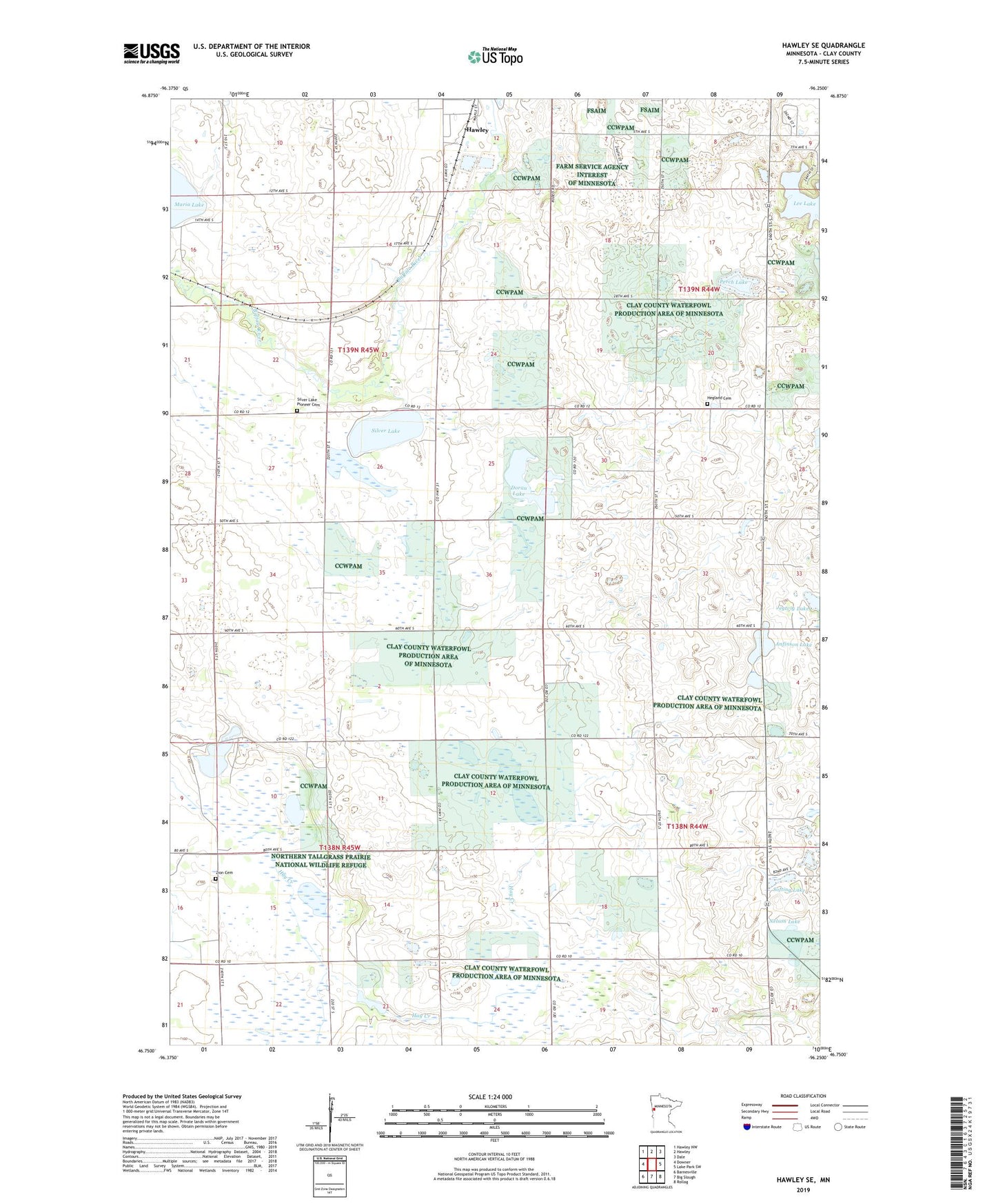
2022 topographic map quadrangle Hawley SE in the state of Minnesota. Scale: 1:24000. Based on the newly updated USGS 7.5' US Topo map series, this map is in the following counties: Clay. The map contains contour data, water features, and other items you are used to seeing on USGS maps, but also has updated roads and other features. This is the next generation of topographic maps. Printed on high-quality waterproof paper with UV fade-resistant inks.
Quads adjacent to this one:
West: Downer
Northwest: Hawley NW
North: Hawley
Northeast: Dale
East: Lake Park SW
Southeast: Rollag
South: Big Slough
Southwest: Barnesville
This map covers the same area as the classic USGS quad with code o46096g3.
Contains the following named places: Anfinson Lake, Bjornson State Wildlife Management Area, Clay County State Wildlife Management Area, Doran Lake, Hawley State Wildlife Management Area, Hegland Cemetery, Hegland Church, Jegtvig Lake, Lee Lake, Maria Lake, Nelson Lake, Perch Lake, Rushfieldt Lake, Silver Lake, Silver Lake Pioneer Cemetery, Skree State Wildlife Management Area, Softing Lake, Township of Hawley, Township of Skree, Zion Cemetery, ZIP Code: 56549