MyTopo
Saginaw Minnesota US Topo Map
Couldn't load pickup availability
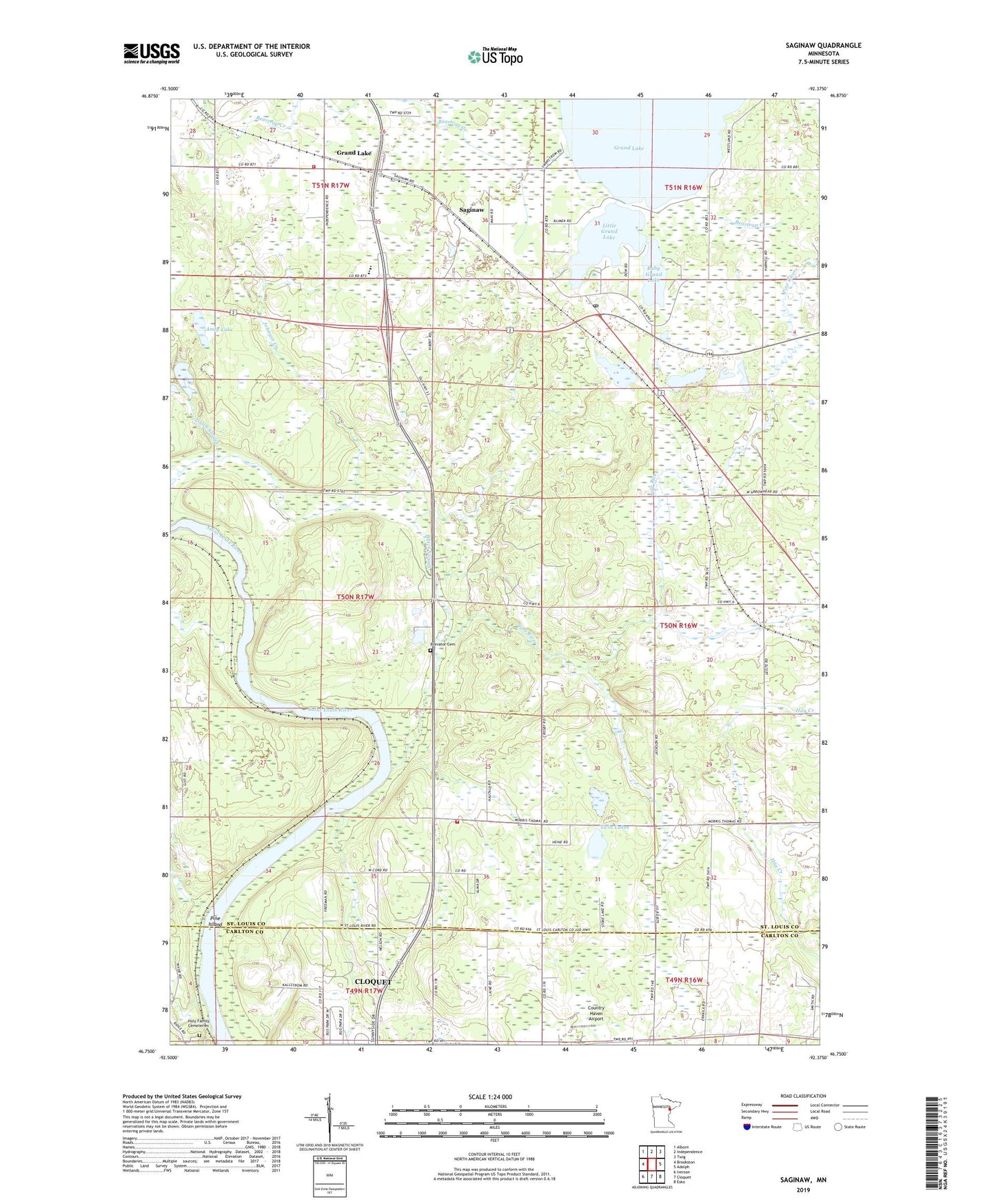
2019 topographic map quadrangle Saginaw in the state of Minnesota. Scale: 1:24000. Based on the newly updated USGS 7.5' US Topo map series, this map is in the following counties: St. Louis, Carlton. The map contains contour data, water features, and other items you are used to seeing on USGS maps, but also has updated roads and other features. This is the next generation of topographic maps. Printed on high-quality waterproof paper with UV fade-resistant inks.
Quads adjacent to this one:
West: Brookston
Northwest: Alborn
North: Independence
Northeast: Twig
East: Adolph
Southeast: Esko
South: Cloquet
Southwest: Iverson
Contains the following named places: Albrook School, Andy Lake, Baby Grand Lake, Brevator Cemetery, Country Haven Airport, Duluth Apostolic Lutheran Church, Dutch Slough, East Brevator Fire Department, Fond du Lac Creek, Grand Lake, Holy Family Cemetery, Industrial Volunteer Fire Department, Johnson Creek, Little Grand Lake, Pine Island, Pine River, Saginaw, Saginaw Post Office, Saginaw Station, Saint Peter's Lutheran Church, Saint Philip Neri Catholic Church, Swan Field, Township of Brevator, Twin Lakes