MyTopo
Brookston Minnesota US Topo Map
Couldn't load pickup availability
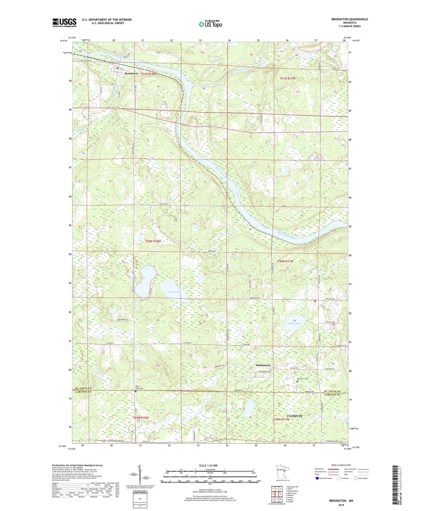
2022 topographic map quadrangle Brookston in the state of Minnesota. Scale: 1:24000. Based on the newly updated USGS 7.5' US Topo map series, this map is in the following counties: St. Louis, Carlton. The map contains contour data, water features, and other items you are used to seeing on USGS maps, but also has updated roads and other features. This is the next generation of topographic maps. Printed on high-quality waterproof paper with UV fade-resistant inks.
Quads adjacent to this one:
West: Martin Lake
Northwest: Brookston NW
North: Alborn
Northeast: Independence
East: Saginaw
Southeast: Cloquet
South: Iverson
Southwest: Sawyer
This map covers the same area as the classic USGS quad with code o46092g5.
Contains the following named places: Artichoke River, Birch Lake Cemetery, Brevator Cemetery, Brevator Fire Department West Hall, Brevator Post Office, Brevator Station, Brookston, Brookston Post Office, Brookston School, Brookston Station, City of Brookston, Cloquet River, Fond du Lac Reservation, Immanuel Lutheran Church, Mahnomen Census Designated Place, Martin Branch, Simian Lake, Stoney Brook, Township of Stoney Brook, Twin Lakes, ZIP Code: 55720