MyTopo
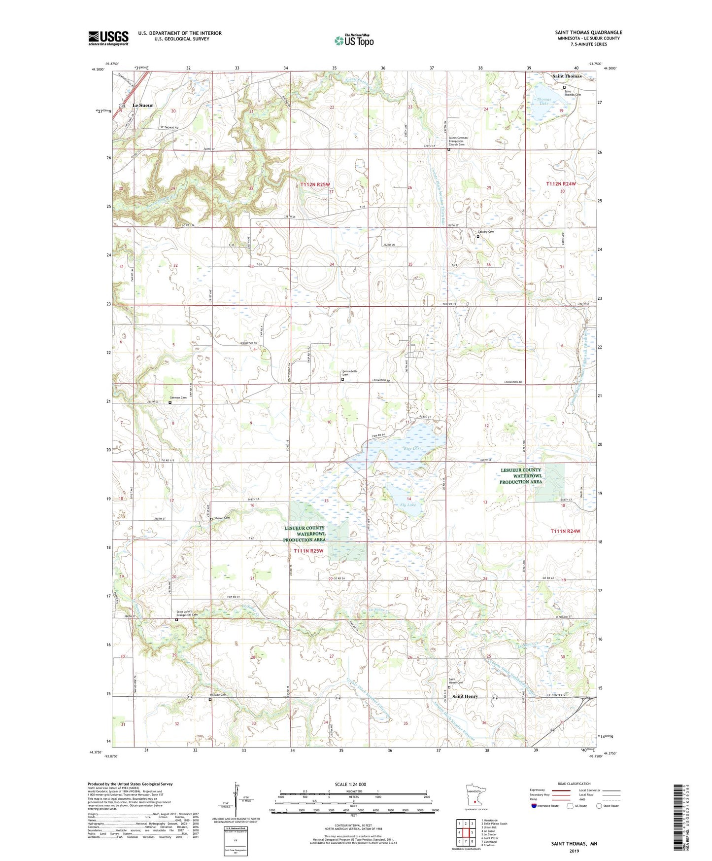
Saint Thomas Minnesota US Topo Map
Couldn't load pickup availability
2019 topographic map quadrangle Saint Thomas in the state of Minnesota. Scale: 1:24000. Based on the newly updated USGS 7.5' US Topo map series, this map is in the following counties: Le Sueur. The map contains contour data, water features, and other items you are used to seeing on USGS maps, but also has updated roads and other features. This is the next generation of topographic maps. Printed on high-quality waterproof paper with UV fade-resistant inks.
Quads adjacent to this one:
West: Le Sueur
Northwest: Henderson
North: Belle Plaine South
Northeast: Union Hill
East: Le Center
Southeast: Cordova
South: Cleveland
Southwest: Saint Peter
Contains the following named places: Calvary Cemetery, Church of Saint Henry, County Ditch Number Eight and Fiftythree, County Ditch Number Fiftyseven, County Ditch Number Fiftysix, County Ditch Number Fiftythree, County Ditch Number Fortyone, County Ditch Number Thirtyfour, Dresselville Cemetery, Ely Lake, German Cemetery, Hillside Cemetery, Rice Lake, Saint Henry, Saint Henry Cemetery, Saint Henry Post Office, Saint John's Evangelical Cemetery, Saint Thomas, Saint Thomas Cemetery, Saint Thomas Post Office, Saint Thomas State Wildlife Management Area, Salem German Evangelical Church Cemetery, Sharon Cemetery, Thomas Lake, Township of Sharon