MyTopo
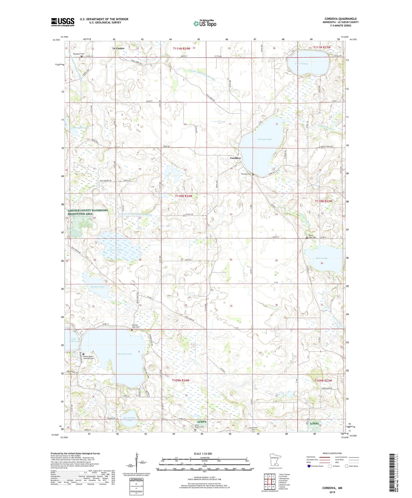
Cordova Minnesota US Topo Map
Couldn't load pickup availability
2022 topographic map quadrangle Cordova in the state of Minnesota. Scale: 1:24000. Based on the newly updated USGS 7.5' US Topo map series, this map is in the following counties: Le Sueur. The map contains contour data, water features, and other items you are used to seeing on USGS maps, but also has updated roads and other features. This is the next generation of topographic maps. Printed on high-quality waterproof paper with UV fade-resistant inks.
Quads adjacent to this one:
West: Cleveland
Northwest: Saint Thomas
North: Le Center
Northeast: Montgomery
East: Kilkenny
Southeast: Waterville
South: Elysian
Southwest: Madison Lake
This map covers the same area as the classic USGS quad with code o44093c6.
Contains the following named places: Bossuot Lake, Chadderdon State Wildlife Management Area, Cordova, Cordova Post Office, County Ditch Number Fifty, County Ditch Number Sixtyeight, County Ditch Number Sixtyfour, County Ditch Number Thirtysix, County Ditch Number Twenty, Factor State Wildlife Management Area, German Lake, German Lake Cemetery, Goose Lake, Gorman Cemetery, Gorman Lake, Gorman Lake Dam, Haugenstein Cemetery, Lake Volney, Le Sueur County, Le Sueur Park, Little Cannon River, Paddy Marsh State Wildlife Management Are, Phebe Jones Lakeside Cemetery, Rice Lake, Roemhildts Lake, Sabre Lake, Sabre Lake Cemetery, Saint Pauls Church, Saint Peter's Cemetery, Saint Peters Church, Sasse Lake, Shanghai Lake, Shanghai Lake State Wildlife Management A, Sleepy Eye Lake, Township of Cordova, Woodlawn Cemetery