
MyTopo
Sebeka Minnesota US Topo Map
Couldn't load pickup availability
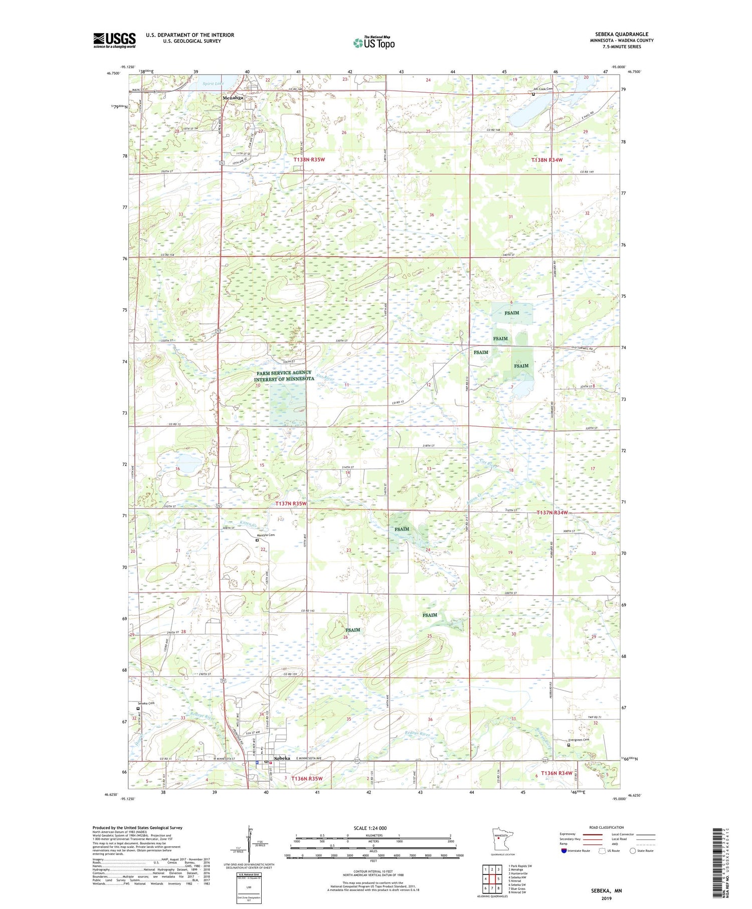
2019 topographic map quadrangle Sebeka in the state of Minnesota. Scale: 1:24000. Based on the newly updated USGS 7.5' US Topo map series, this map is in the following counties: Wadena. The map contains contour data, water features, and other items you are used to seeing on USGS maps, but also has updated roads and other features. This is the next generation of topographic maps. Printed on high-quality waterproof paper with UV fade-resistant inks.
Quads adjacent to this one:
West: Sebeka NW
Northwest: Park Rapids SW
North: Menahga
Northeast: Huntersville
East: Nimrod
Southeast: Nimrod SW
South: Blue Grass
Southwest: Sebeka SW
Contains the following named places: City of Menahga, City of Sebeka, Evergreen Cemetery, Hay Creek, Jim Cook Cemetery, Jim Cook Lake, Kitten Creek, Mantyla Cemetery, Meadow Church, Menahga Campground, School Number 2438, Sebeka, Sebeka Cemetery, Sebeka Fire and Rescue, Sebeka Police Department, Sebeka Post Office, Spirit Lake, Township of Red Eye, ZIP Code: 56477


