MyTopo
Sebeka SW Minnesota US Topo Map
Couldn't load pickup availability
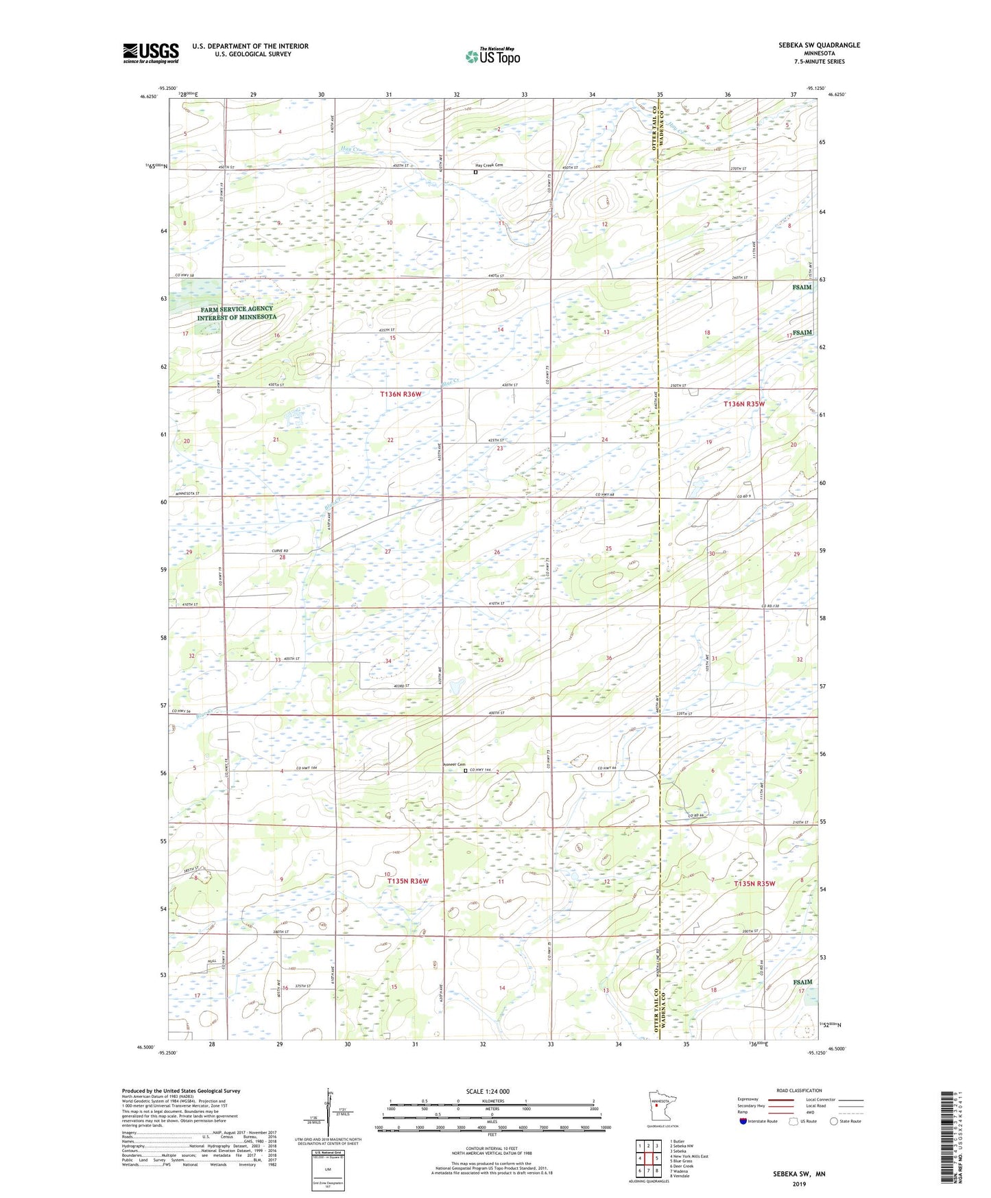
2022 topographic map quadrangle Sebeka SW in the state of Minnesota. Scale: 1:24000. Based on the newly updated USGS 7.5' US Topo map series, this map is in the following counties: Otter Tail, Wadena. The map contains contour data, water features, and other items you are used to seeing on USGS maps, but also has updated roads and other features. This is the next generation of topographic maps. Printed on high-quality waterproof paper with UV fade-resistant inks.
Quads adjacent to this one:
West: New York Mills East
Northwest: Butler
North: Sebeka NW
Northeast: Sebeka
East: Blue Grass
Southeast: Verndale
South: Wadena
Southwest: Deer Creek
This map covers the same area as the classic USGS quad with code o46095e2.
Contains the following named places: Green Valley Church, Hay Creek Cemetery, Maple Ridge Stock Farm, Pioneer Cemetery, Township of Blowers, Township of Bluffton