MyTopo
Shelly Minnesota US Topo Map
Couldn't load pickup availability
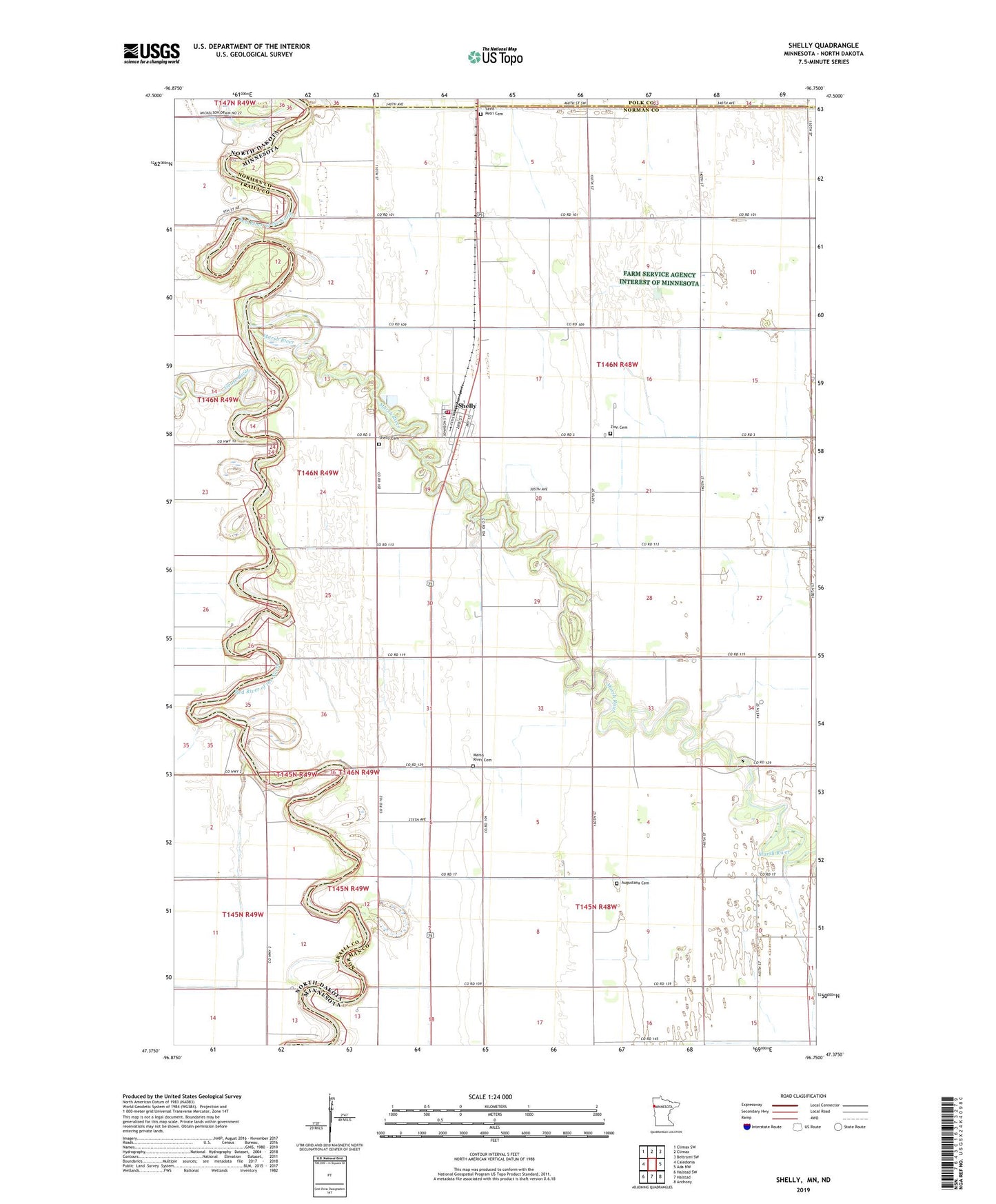
2022 topographic map quadrangle Shelly in the states of Minnesota, North Dakota. Scale: 1:24000. Based on the newly updated USGS 7.5' US Topo map series, this map is in the following counties: Norman, Traill, Polk. The map contains contour data, water features, and other items you are used to seeing on USGS maps, but also has updated roads and other features. This is the next generation of topographic maps. Printed on high-quality waterproof paper with UV fade-resistant inks.
Quads adjacent to this one:
West: Caledonia
Northwest: Climax SW
North: Climax
Northeast: Beltrami SW
East: Ada NW
Southeast: Anthony
South: Halstad
Southwest: Halstad SW
Contains the following named places: Augustana Cemetery, Augustana Church, City of Shelly, Colenso Post Office, County Ditch Number Three, Goose River, Herberg School, Herberg Town Hall, Judicial Ditch Number Fiftyfour, Judicial Ditch Number Two, Kalmer Post Office, Marsh River, Marsh River Cemetery, Saint Petri Cemetery, Shelly, Shelly Cemetery, Shelly City Hall, Shelly Fire Department, Shelly Lutheran Church, Shelly Post Office, Steenerson Drain, Township of Shelly, Traill County Poor Farm Cemetery, Zion Cemetery, Zion Church, ZIP Code: 56581