MyTopo
Silver Lake Minnesota US Topo Map
Couldn't load pickup availability
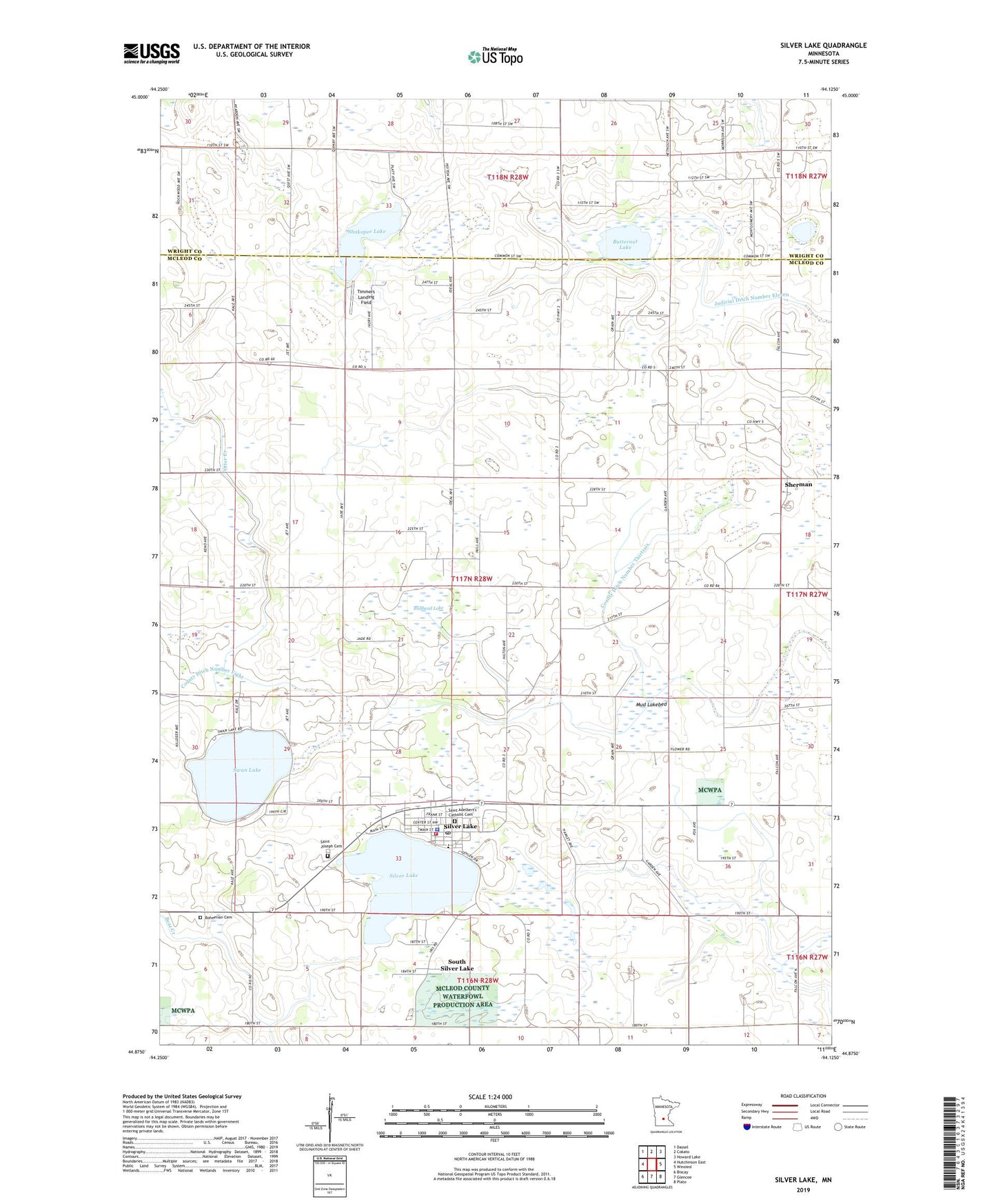
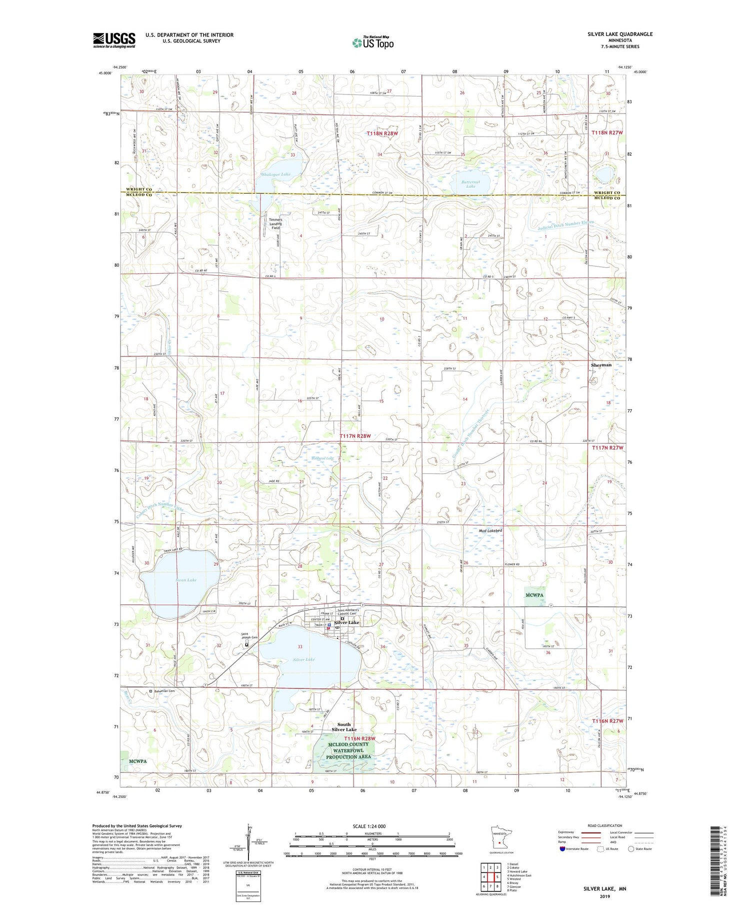
2019 topographic map quadrangle Silver Lake in the state of Minnesota. Scale: 1:24000. Based on the newly updated USGS 7.5' US Topo map series, this map is in the following counties: McLeod, Wright. The map contains contour data, water features, and other items you are used to seeing on USGS maps, but also has updated roads and other features. This is the next generation of topographic maps. Printed on high-quality waterproof paper with UV fade-resistant inks.
Quads adjacent to this one:
West: Hutchinson East
Northwest: Dassel
North: Cokato
Northeast: Howard Lake
East: Winsted
Southeast: Plato
South: Glencoe
Southwest: Biscay
Contains the following named places: Bohemian Cemetery, Bullhead Lake, Butternut Lake, Carlson's Orchard, Church of the Holy Family, City of Silver Lake, County Ditch Number Eight, County Ditch Number Forty, County Ditch Number Thirtyfive, County Ditch Number Thirtysix, County Ditch Number Thirtytwo, Dahl School, Faith Church, First Congregational Church, Henrys Corner, Judicial Ditch Number Eleven, Lakeside Elementary School, Mud Lake, Mud Lakebed, Presbyterian Church, Saint Adelbert's Catholic Cemetery, Saint Joseph Cemetery, School Number 1014, School Number 987, Shakopee Lake, Sherman, Silver Lake, Silver Lake Catholic School, Silver Lake City Hall, Silver Lake Fire Department, Silver Lake Police Department, Silver Lake Post Office, South Silver Lake, Swan Lake, Swan Lake County Park, Timmers Landing Field, Township of Hale, ZIP Code: 55381