MyTopo
Biscay Minnesota US Topo Map
Couldn't load pickup availability
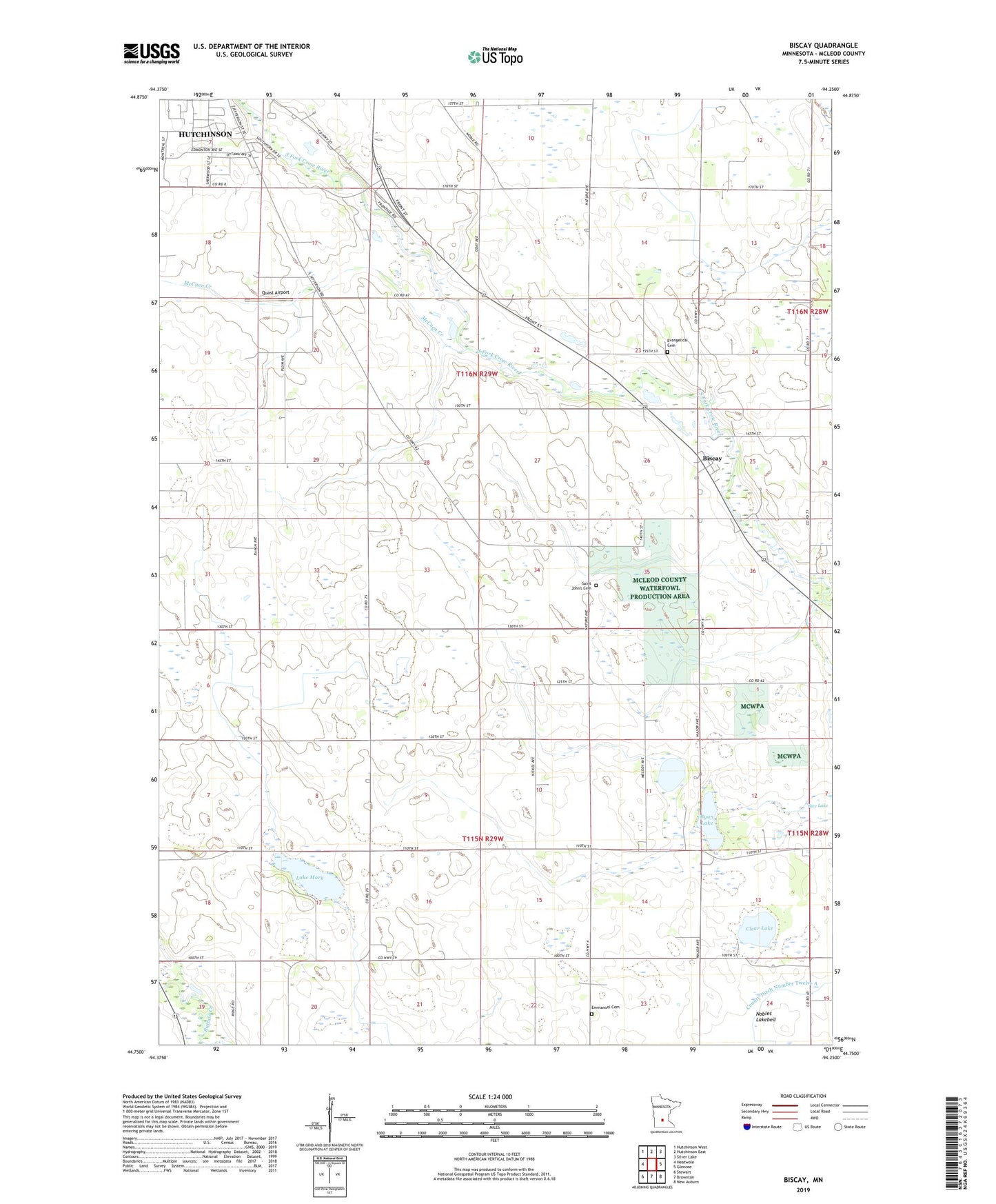
2022 topographic map quadrangle Biscay in the state of Minnesota. Scale: 1:24000. Based on the newly updated USGS 7.5' US Topo map series, this map is in the following counties: McLeod. The map contains contour data, water features, and other items you are used to seeing on USGS maps, but also has updated roads and other features. This is the next generation of topographic maps. Printed on high-quality waterproof paper with UV fade-resistant inks.
Quads adjacent to this one:
West: Heatwole
Northwest: Hutchinson West
North: Hutchinson East
Northeast: Silver Lake
East: Glencoe
Southeast: New Auburn
South: Brownton
Southwest: Stewart
This map covers the same area as the classic USGS quad with code o44094g3.
Contains the following named places: Biscay, Biscay Post Office, City of Biscay, Clear Lake, County Ditch Number Twentyseven, Elks Park, Emmanuel Cemetery, Evangelical Cemetery, Ewald Landing Strip, Lake Mary, McCuen Creek, McLeod County, McLeod County Waterfowl Production Area, Nobles Lakebed, Quast Airport, Rice Lake, Ridgewater college, Ryan Lake, Saint John's Cemetery, Saint Johns Church, School Number 985, Township of Hassan Valley, Township of Sumter