MyTopo
Glencoe Minnesota US Topo Map
Couldn't load pickup availability
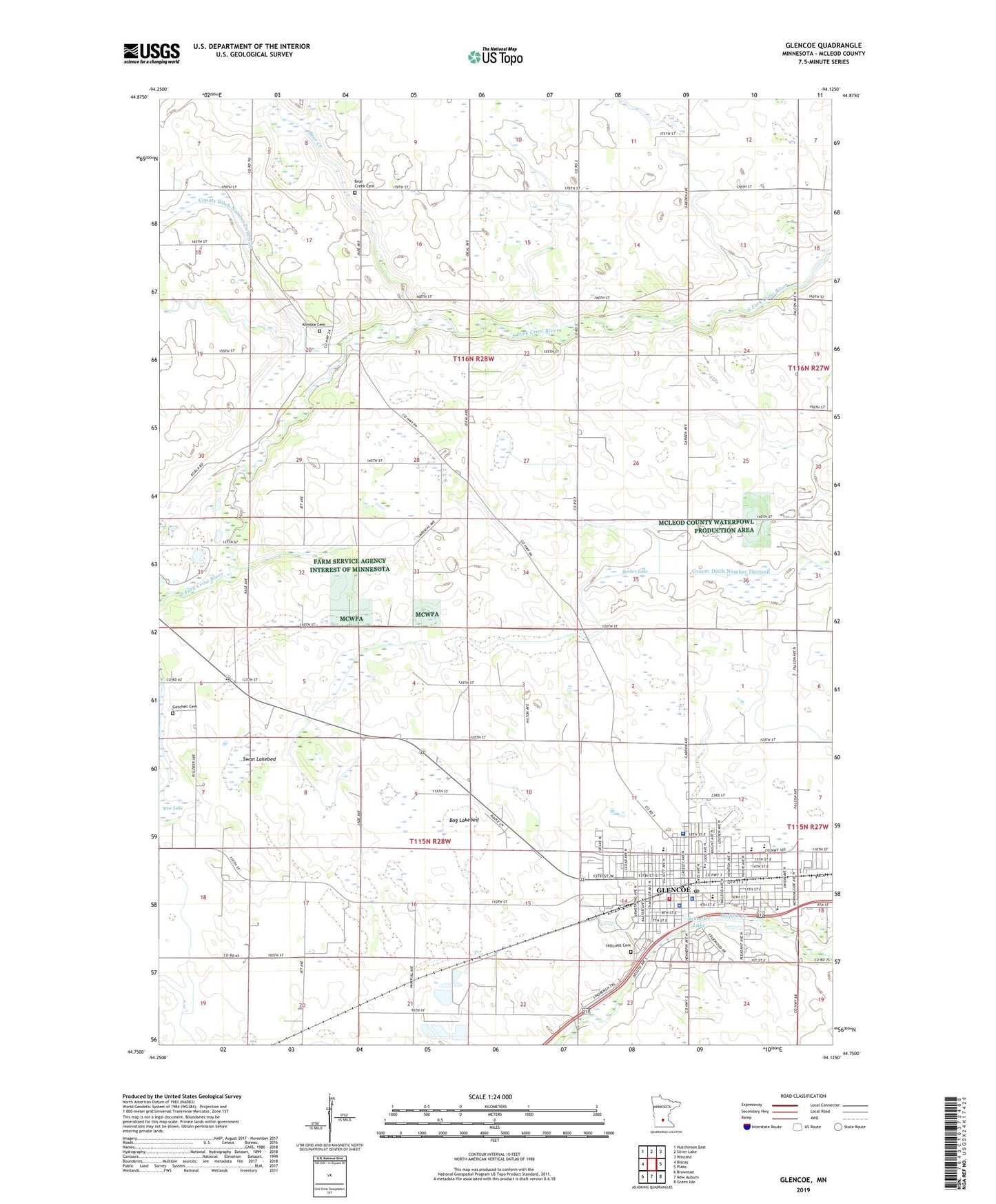
2022 topographic map quadrangle Glencoe in the state of Minnesota. Scale: 1:24000. Based on the newly updated USGS 7.5' US Topo map series, this map is in the following counties: McLeod. The map contains contour data, water features, and other items you are used to seeing on USGS maps, but also has updated roads and other features. This is the next generation of topographic maps. Printed on high-quality waterproof paper with UV fade-resistant inks.
Quads adjacent to this one:
West: Biscay
Northwest: Hutchinson East
North: Silver Lake
Northeast: Winsted
East: Plato
Southeast: Green Isle
South: New Auburn
Southwest: Brownton
This map covers the same area as the classic USGS quad with code o44094g2.
Contains the following named places: Anderson Court, Baker Elementary School, Barber Lake, Bear Creek, Bear Creek Cemetery, Beihoffer Lake, Berean Baptist Church, Bog Lakebed, Christ Lutheran Church, Church of Peace, City of Glencoe, County Ditch Number Twelve A, County Ditch Number Twentysix, First Congregational Church, First Lutheran Church, First Lutheran School, Getchell Cemetery, Glen Knoll Mobile Home Park, Glencoe, Glencoe - Silver Lake Senior High School, Glencoe Christian Church, Glencoe City Library, Glencoe Country Club, Glencoe Fire Department, Glencoe Fort Historical Marker, Glencoe Medical Clinic, Glencoe Police Department, Glencoe Post Office, Glencoe Regional Health Services Hospital, Good Shepherd Lutheran Church, Henry Hill Intermediate School, Hillcrest Cemetery, Koniska, Koniska Cemetery, Koniska Post Office, Lincoln Junior High School, Lincoln Park, McLeod County Courthouse, McLeod County Jail, McLeod County Sheriff's Office, Oak Leaf Park, Perez Mobile Home Park, Saint Pius X Catholic Church, Saint Pius X Catholic School, School Number 1011, School Number 996, Sunrise Court, Swan Lakebed, Township of Glencoe, Township of Rich Valley, ZIP Code: 55336