MyTopo
Skunk Lake Minnesota US Topo Map
Couldn't load pickup availability
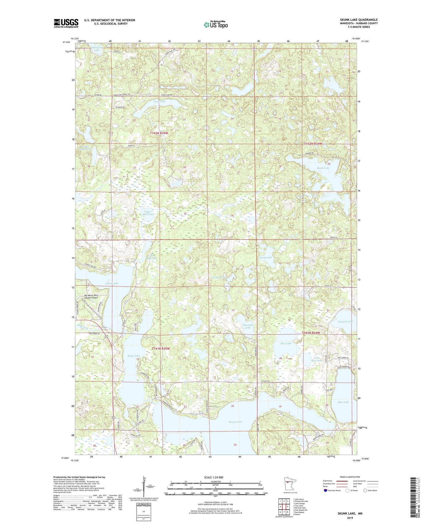
2019 topographic map quadrangle Skunk Lake in the state of Minnesota. Scale: 1:24000. Based on the newly updated USGS 7.5' US Topo map series, this map is in the following counties: Hubbard. The map contains contour data, water features, and other items you are used to seeing on USGS maps, but also has updated roads and other features. This is the next generation of topographic maps. Printed on high-quality waterproof paper with UV fade-resistant inks.
Quads adjacent to this one:
West: Two Inlets
Northwest: Lake Itasca
North: Schoolcraft Lake
Northeast: Lake George
East: Mantrap Lake
Southeast: Dorset
South: Park Rapids
Southwest: Park Rapids NW
Contains the following named places: Blacksmith Lake, Blue Lake, Breeze Campgrounds, Churchill Lake, Coon Lake, Crooked Lake, Eagle Lake, Eagles View Golf Course, Hay Creek, Island Lake, Little Rice Lake, Lower Camel Lake, Lower Mud Lake, Many Arm Lake, Potato Lake, Rice Lake, Sawyer Lake, Skunk Lake, Sky Manor Aero Estates Airport, Stony Lake, Township of Arago, Township of Clover, Upper Camel Lake, Upper Mud Lake, Vagabond Village Campground, Wabisish Lake, ZIP Code: 56470