MyTopo
Spring Lake Minnesota US Topo Map
Couldn't load pickup availability
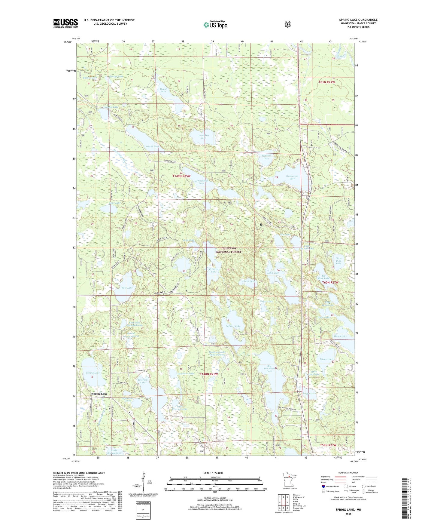
2019 topographic map quadrangle Spring Lake in the state of Minnesota. Scale: 1:24000. Based on the newly updated USGS 7.5' US Topo map series, this map is in the following counties: Itasca. The map contains contour data, water features, and other items you are used to seeing on USGS maps, but also has updated roads and other features. This is the next generation of topographic maps. Printed on high-quality waterproof paper with UV fade-resistant inks.
Quads adjacent to this one:
West: Wirt
Northwest: Pomroy
North: Wildwood SE
Northeast: Effie
East: Bigfork
Southeast: Marcell
South: Jessie Lake
Southwest: Bowstring Lake
Contains the following named places: Ackerman Lakes, Arrowhead Lake, Backus Lake, Big Rose Lake, Big Too Much Lake, Boggy Lake, Border Impoundment, Crooked Lake, Crooked Lake Impoundment, David Lake, East Lake, East Lake Dam, East Lake Impoundment, Elbow Lake, Elm Lake, Fisher Lake, George Lake, Goodman Lake, Goodman Lake Impoundment, Gunderson Lake, Hatch Lake, Holland Lake, La Croix Number One Impoundment, La Croix Number Two Impoundment, Lac-a-Roy Lake, LaCroix Lake, Little Mud Lake, Little Peterson Lake, Little Rose Lake, Little Round Lake, Long Lake, Mount Tabor Camp, Park Lake, Peterson Lake, Pickerel Lake, Riverside Chapel, Riverside Church, Rock Lake, Spring Lake, Spring Lake Creek, Spring Lake Post Office, Spur Lake, Spur Lake Impoundment, Spur Lake Trail System, Township of Lake Jessie, Trestle Lake, Twin Lakes, Upper Hatch Lake