MyTopo
Steamboat Lake Minnesota US Topo Map
Couldn't load pickup availability
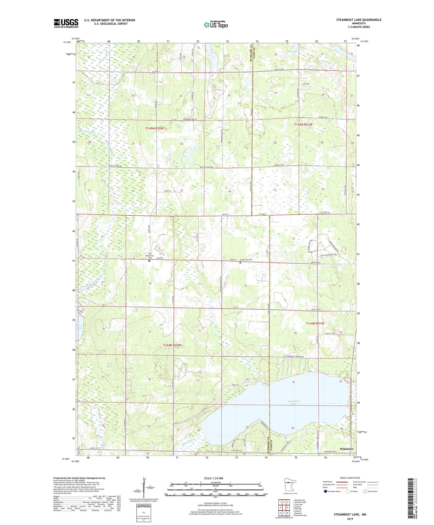
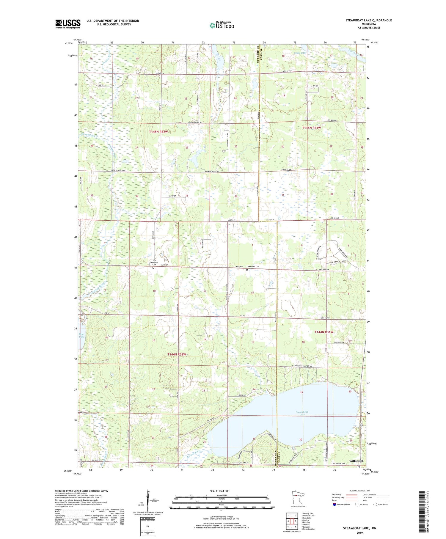
2019 topographic map quadrangle Steamboat Lake in the state of Minnesota. Scale: 1:24000. Based on the newly updated USGS 7.5' US Topo map series, this map is in the following counties: Hubbard, Cass. The map contains contour data, water features, and other items you are used to seeing on USGS maps, but also has updated roads and other features. This is the next generation of topographic maps. Printed on high-quality waterproof paper with UV fade-resistant inks.
Quads adjacent to this one:
West: Guthrie
Northwest: Bemidji East
North: Andrusia Lake
Northeast: Cass Lake
East: Pike Bay
Southeast: Steamboat Bay
South: Benedict
Southwest: Laporte
Contains the following named places: Ben Israel Fellowship, Bowman Lake, Bungashing Creek, Green Lea Cemetery, Necktie River, Raboin, Raboin Post Office, Richard Lake, Spike Lake, Steamboat Lake, Township of Farden, Township of Hart Lake, Wilkinson, Wilkinson Post Office, Zion Memorial Cemetery