MyTopo
Bemidji East Minnesota US Topo Map
Couldn't load pickup availability
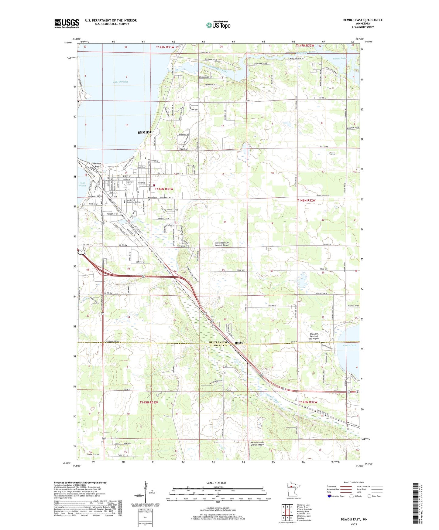
2022 topographic map quadrangle Bemidji East in the state of Minnesota. Scale: 1:24000. Based on the newly updated USGS 7.5' US Topo map series, this map is in the following counties: Beltrami, Hubbard. The map contains contour data, water features, and other items you are used to seeing on USGS maps, but also has updated roads and other features. This is the next generation of topographic maps. Printed on high-quality waterproof paper with UV fade-resistant inks.
Quads adjacent to this one:
West: Bemidji West
Northwest: Peterson Lake
North: Turtle River
Northeast: Turtle River Lake
East: Andrusia Lake
Southeast: Steamboat Lake
South: Guthrie
Southwest: Frontenac Lake
This map covers the same area as the classic USGS quad with code o47094d7.
Contains the following named places: A C Clark Library, Aardahl Church, American Indian Resource Center, Bahai Faith, Bemidji Fire Department Station 2, Bemidji State University, Birch Hall, Bridgeman Hall, Calvary Cemetery, Calvary Lutheran Church, Cameron Park, Cedar Apartments, Chandler Personal Use Airport, Chet Anderson Stadium, Church of Christ, Cloverleaf-East Bemidji Airport, David Park House, Decker Hall, Diamond Point Park, Education - Art Education, Faith Baptist Church, First Assembly of God Church, Hagg-Sauer Hall, Heating Plant, Honors House, KBSB-FM (Bemidji), KKBJ-AM (Bemidji), Lincoln School, Linden Hall, Maple Ridge Golf Course, Mount Zion Church, Northwest Technical College, Norway Park, Nymore Beach, Nymore Cemetery, Nymore Park, Nymore Post Office, Peters Aquatic Laboratory, Phil Sauer House, Pine Hall, Revival Tabernacle Church, Rosby, Rosby Post Office, Royal Oaks RV Park, Sattgast Hall of Science, Southview Mobile Home Park, Stump Lake, Tamarack Hall, Township of Bemidji, Trinity Church, Waterfront/Boat House