
MyTopo
Wabana Lake Minnesota US Topo Map
Couldn't load pickup availability
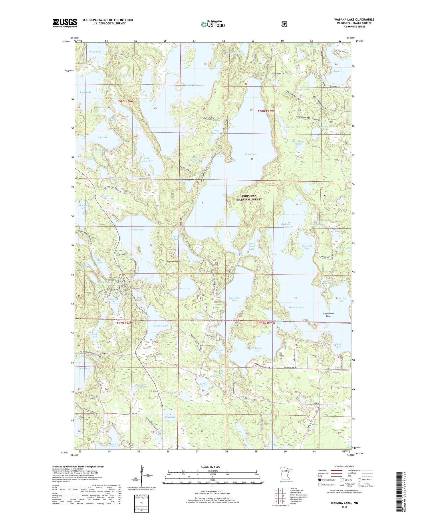
2019 topographic map quadrangle Wabana Lake in the state of Minnesota. Scale: 1:24000. Based on the newly updated USGS 7.5' US Topo map series, this map is in the following counties: Itasca. The map contains contour data, water features, and other items you are used to seeing on USGS maps, but also has updated roads and other features. This is the next generation of topographic maps. Printed on high-quality waterproof paper with UV fade-resistant inks.
Quads adjacent to this one:
West: Little Bowstring Lake
Northwest: Marcell
North: Clubhouse Lake
Northeast: Balsam Lake
East: Lawrence Lake West
Southeast: Bovey
South: Cohasset East
Southwest: Cohasset West
Contains the following named places: Arrowhead Point, Beaver Lake, Beavertail Lake, Bee Cee Lake, Birch Bay, Bluebill Lake, Bluebill Pond, Bluewater Lake, Bobby Lake, Bosely Lake, Buckman Cove, Buhella Lake, Circle Lake, Day Lake, Dead Horse Lake, Doan Lake, Francis Lake, Hill Lake, Irma Lake, Island Lake, Johnson Lake, Lake Charlotte, Lawrence Lake, Leoneth Post Office, Little Bear Lake, Little Long Lake, Little Trout Lake, Little Wolf Lake, Long Lake, Lower Spring Lake, Lucky Lake, Martin, Moonshine Lake, Moore Lake, Murphy Bay, Orange Lake, Otter Lake, Pickerel Bay, Pickerel Lake, Pug Hole Lake, Pug Hole Lake Wayside Park, Roland Lake, Sand Lake, Shelly Lake, Simmons Bay, Snowshoe Lake, Spider Lake, Spring Lake, Spruce Lake, Sunrise Lake, Township of Wabana, Trout Lake, Trout Lake Management Area, Twin Lake, Upper Spring Lake, Wabana Impoundment, Wabana Lake, Wakeman Bay, Wolf Lake


