MyTopo
Waltham Minnesota US Topo Map
Couldn't load pickup availability
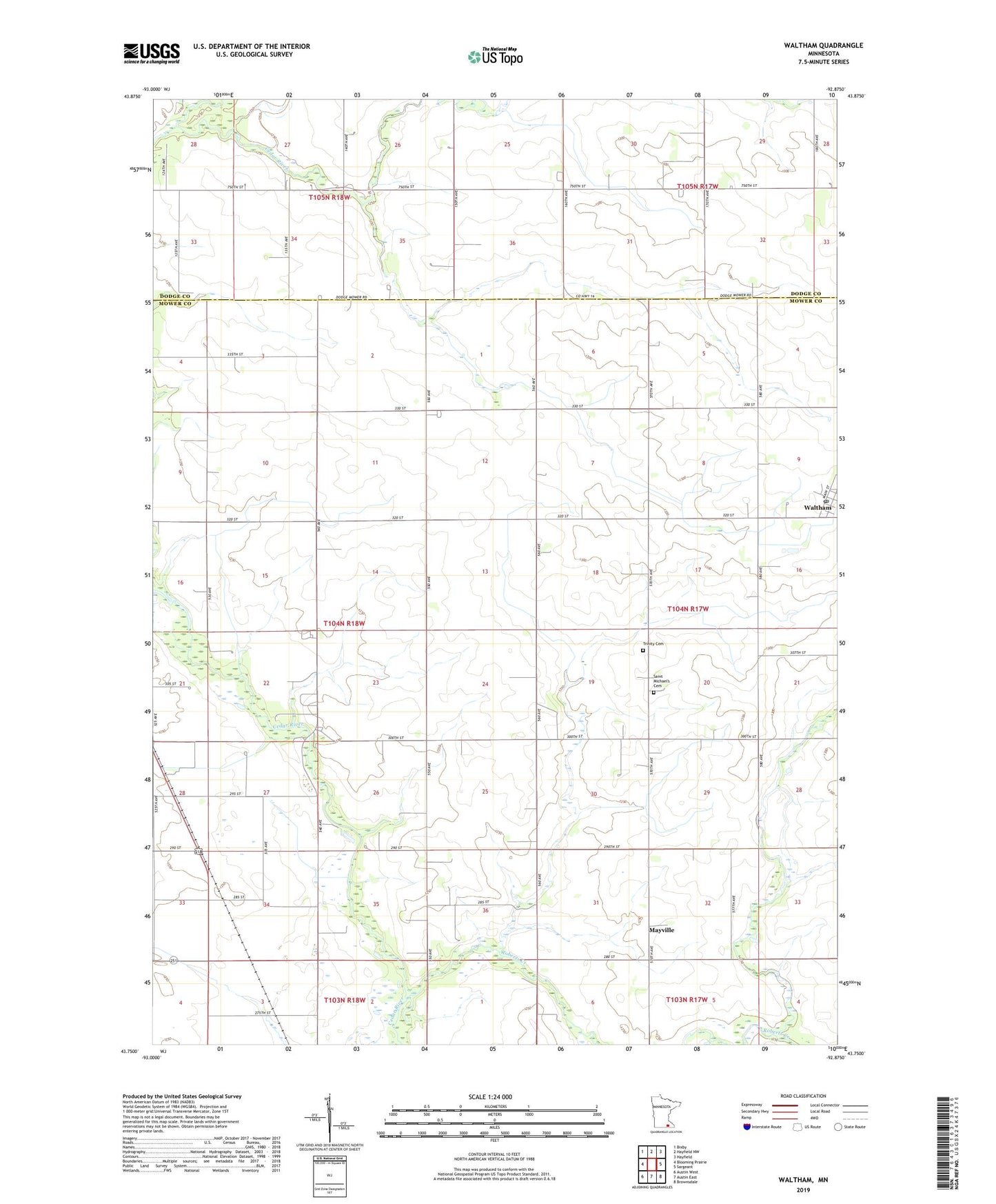
2019 topographic map quadrangle Waltham in the state of Minnesota. Scale: 1:24000. Based on the newly updated USGS 7.5' US Topo map series, this map is in the following counties: Mower, Dodge. The map contains contour data, water features, and other items you are used to seeing on USGS maps, but also has updated roads and other features. This is the next generation of topographic maps. Printed on high-quality waterproof paper with UV fade-resistant inks.
Quads adjacent to this one:
West: Blooming Prairie
Northwest: Bixby
North: Hayfield NW
Northeast: Hayfield
East: Sargeant
Southeast: Brownsdale
South: Austin East
Southwest: Austin West
Contains the following named places: Little Cedar River, Mayville, Mayville Post Office, River Trail Camp, Roberts Creek, Saint Michael's Cemetery, Saint Michaels Church, Township of Udolpho, Trinity Cemetery, Trinity Lutheran Church, Trinity School, Waltham, Waltham Post Office, ZIP Code: 55982