MyTopo
Blooming Prairie Minnesota US Topo Map
Couldn't load pickup availability
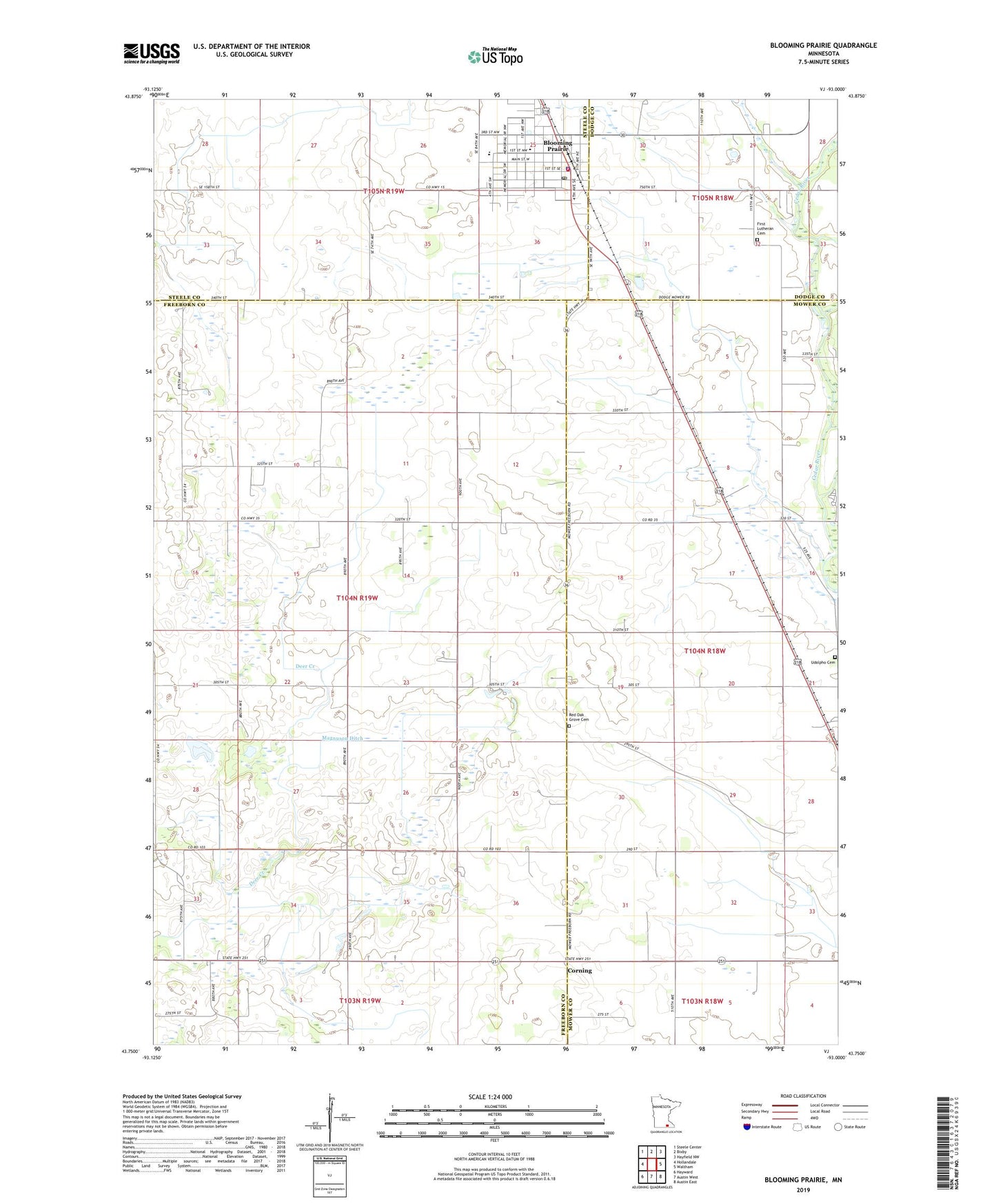
2022 topographic map quadrangle Blooming Prairie in the state of Minnesota. Scale: 1:24000. Based on the newly updated USGS 7.5' US Topo map series, this map is in the following counties: Freeborn, Mower, Steele, Dodge. The map contains contour data, water features, and other items you are used to seeing on USGS maps, but also has updated roads and other features. This is the next generation of topographic maps. Printed on high-quality waterproof paper with UV fade-resistant inks.
Quads adjacent to this one:
West: Hollandale
Northwest: Steele Center
North: Bixby
Northeast: Hayfield NW
East: Waltham
Southeast: Austin East
South: Austin West
Southwest: Hayward
This map covers the same area as the classic USGS quad with code o43093g1.
Contains the following named places: Bass Mobile Home Park, Blooming Prairie, Blooming Prairie Ambulance, Blooming Prairie Clinic, Blooming Prairie Elementary School, Blooming Prairie Fire Department, Blooming Prairie High School, Blooming Prairie Library, Blooming Prairie Police Department, Blooming Prairie Post Office, Brookside Campground, City of Blooming Prairie, Corning, First Baptist Church, First Lutheran Cemetery, First Lutheran Church, Magnuson Ditch, Prairie Manor, Red Oak Grove Cemetery, Red Oak Grove Church, Saint Columbanus Church, Township of Newry, Udolpho Cemetery, United Methodist Church