MyTopo
White Rock Minnesota US Topo Map
Couldn't load pickup availability
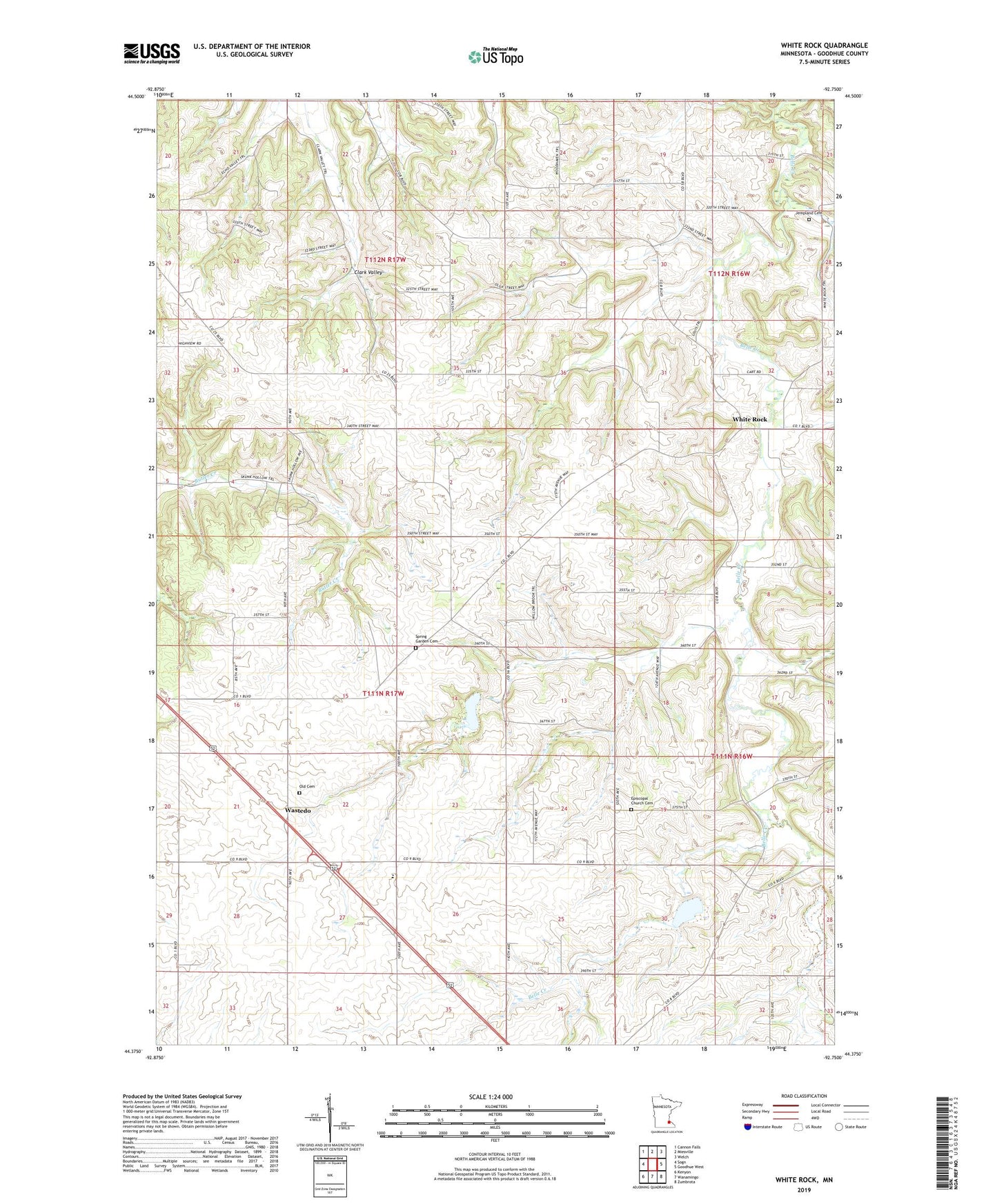
2019 topographic map quadrangle White Rock in the state of Minnesota. Scale: 1:24000. Based on the newly updated USGS 7.5' US Topo map series, this map is in the following counties: Goodhue. The map contains contour data, water features, and other items you are used to seeing on USGS maps, but also has updated roads and other features. This is the next generation of topographic maps. Printed on high-quality waterproof paper with UV fade-resistant inks.
Quads adjacent to this one:
West: Sogn
Northwest: Cannon Falls
North: Miesville
Northeast: Welch
East: Goodhue West
Southeast: Zumbrota
South: Wanamingo
Southwest: Kenyon
Contains the following named places: Belle Creek, Belle Creek Post Office, Belle Creek R-1 Dam, Belle Creek R-4 Dam, Charles Vangsness Dam, Donald Banks Group Dam, Eldon Anderson Dam, Episcopal Church Cemetery, Evan Josephson Dam, Jempland Cemetery, Kepner Group Dam, Old Cemetery, Peaceful Valley Group Structure Number 1 Dam, Spring Garden Cemetery, Spring Garden Church, Swanson Holm and Hemmah Group Dam, Township of Cannon Falls, Township of Leon, Wastedo, Wastedo Post Office, Wastedo School, White Rock, Whiterock Post Office, ZIP Code: 55009