MyTopo
Cannon Falls Minnesota US Topo Map
Couldn't load pickup availability
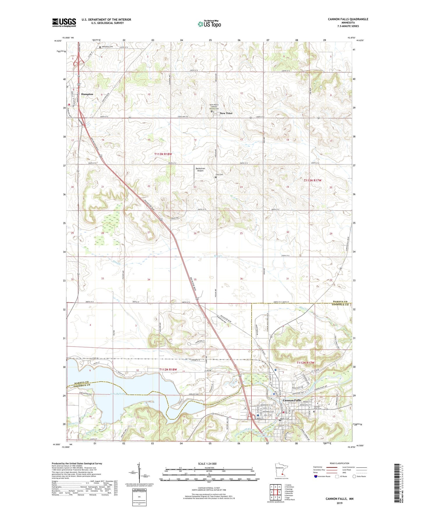
2022 topographic map quadrangle Cannon Falls in the state of Minnesota. Scale: 1:24000. Based on the newly updated USGS 7.5' US Topo map series, this map is in the following counties: Dakota, Goodhue. The map contains contour data, water features, and other items you are used to seeing on USGS maps, but also has updated roads and other features. This is the next generation of topographic maps. Printed on high-quality waterproof paper with UV fade-resistant inks.
Quads adjacent to this one:
West: Randolph
Northwest: Coates
North: Vermillion
Northeast: Hastings
East: Miesville
Southeast: White Rock
South: Sogn
Southwest: Dennison
This map covers the same area as the classic USGS quad with code o44092e8.
Contains the following named places: Backstrom Airport, Byllesby Dam, Cannon Community Church, Cannon Country Club, Cannon Falls, Cannon Falls Ambulance Service, Cannon Falls Assembly of God Church, Cannon Falls Cemetery, Cannon Falls City Hall, Cannon Falls Community Hospital, Cannon Falls Elementary School, Cannon Falls Fire Department, Cannon Falls Health Center, Cannon Falls High School, Cannon Falls Historical Museum, Cannon Falls Library, Cannon Falls Police Department, Cannon Falls Post Office, Cannon Falls School, Cannon Falls Softball Field, Cannon River Camp, Cannon Valley Fairgrounds, Church of Christ, Church of Redeemer Episcopal, City of Cannon Falls, City of New Trier, East Side Park, First Baptist Church, First Congregational Church, First English Lutheran Church, Hampton, Hampton Cemetery, Hampton City Hall, Hampton Post Office, Hannahs Bend Park, Judicial Ditch Number One, Lake Byllesbay Campground, Lake Byllesby, Lake Byllesby County Park, Lake Fredrickson, Little Cannon River, Little Cannon River Dam, Minnieska Park, New Trier, New Trier Post Office, Our Lady of the Angels Care Court, Our Savior's Evangelical Church, Prairie Creek, Randolph - Hampton Fire Department Station 2, Riverside Park, Riverside Terrace Mobile Court, Riverwood Community Church, Saint Ansgar's Lutheran Church, Saint Mary Elementary School, Saint Mary's Catholic Church Cemetery, Saint Mary's Church, Saint Paul's Evangelical Church, Saint Paul's Lutheran School, Saint Pius V Church, Spring Creek, Summit Golf Club, Sunshine Orchard, Township of Hampton, Township of Randolph, William Colvill State Monument, Zion Cemetery, ZIP Code: 55031