MyTopo
Williams Minnesota US Topo Map
Couldn't load pickup availability
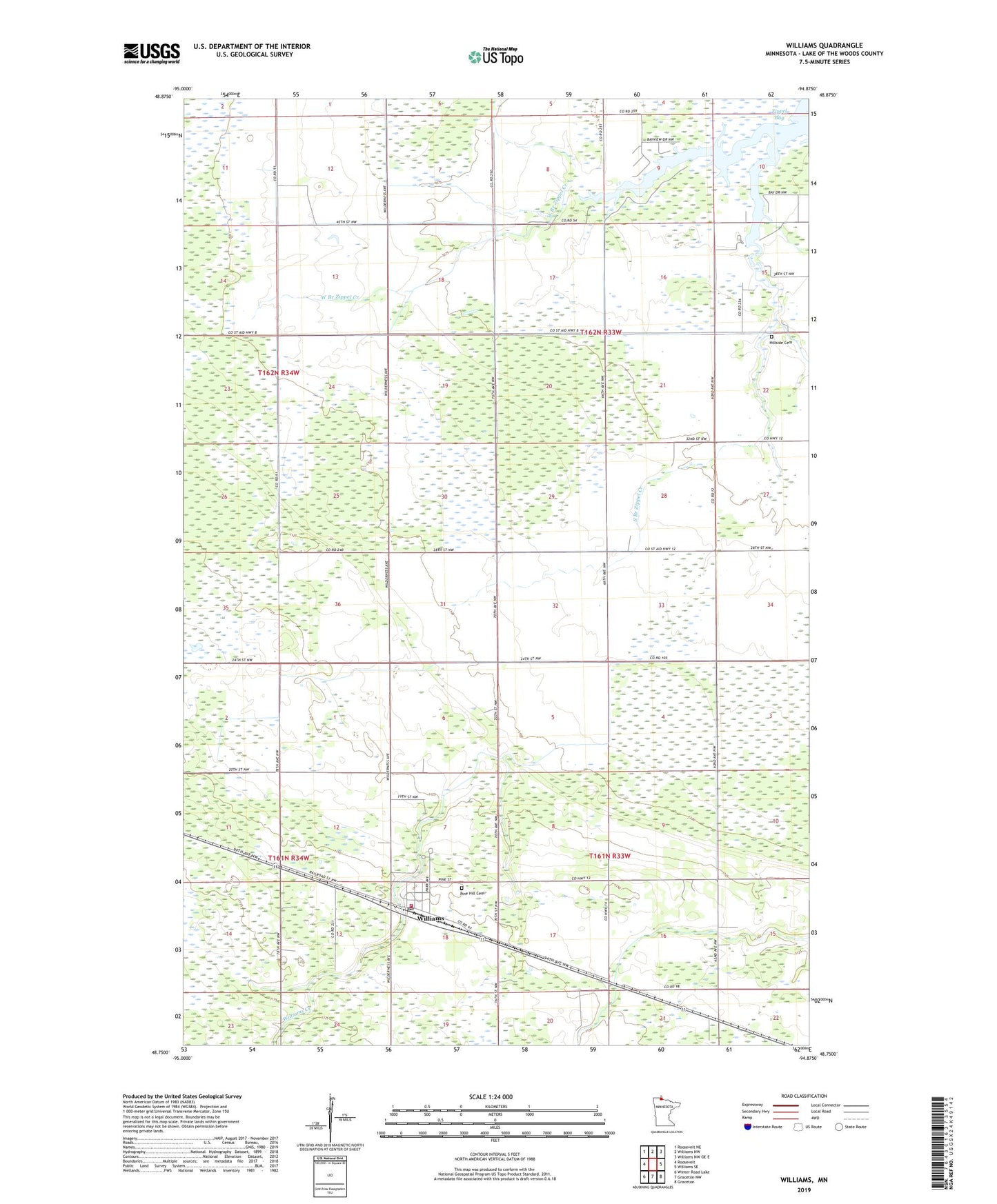
2022 topographic map quadrangle Williams in the state of Minnesota. Scale: 1:24000. Based on the newly updated USGS 7.5' US Topo map series, this map is in the following counties: Lake of the Woods. The map contains contour data, water features, and other items you are used to seeing on USGS maps, but also has updated roads and other features. This is the next generation of topographic maps. Printed on high-quality waterproof paper with UV fade-resistant inks.
Quads adjacent to this one:
West: Roosevelt
Northwest: Roosevelt NE
North: Williams NW
Northeast: Williams NW OE E
East: Williams SE
Southeast: Graceton
South: Graceton NW
Southwest: Winter Road Lake
This map covers the same area as the classic USGS quad with code o48094g8.
Contains the following named places: Assembly of God Church, Bethel Lutheran Church, Cedar Spur Post Office, Cedar Spur Station, City of Williams, County Ditch Number One, Hillside Cemetery, Lady Slipper Park Rest Area, Lake of the Woods County, Pilgrim Congregational Church, Pine Hill Cemetery, Saint Joseph Catholic Church, South Branch Zippel Creek, Tourist Park, Township of McDougald, Township of Zippel, West Branch Zippel Creek, Williams, Williams City Park Campground, Williams Community Church, Williams Creek, Williams Library, Williams Post Office, Williams Volunteer Fire Department, Zippel Bay Resort Campground, ZIP Code: 56686