MyTopo
Winter Road Lake SW Minnesota US Topo Map
Couldn't load pickup availability
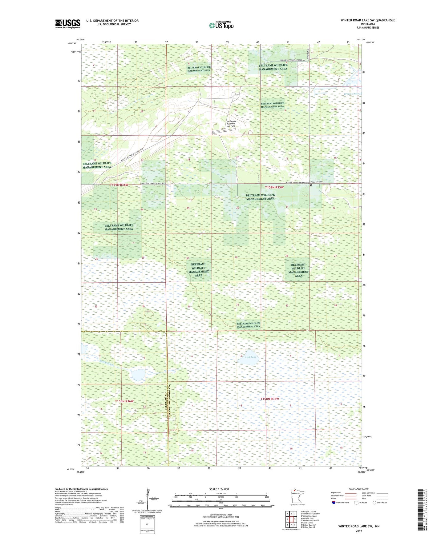
2022 topographic map quadrangle Winter Road Lake SW in the state of Minnesota. Scale: 1:24000. Based on the newly updated USGS 7.5' US Topo map series, this map is in the following counties: Lake of the Woods, Beltrami. The map contains contour data, water features, and other items you are used to seeing on USGS maps, but also has updated roads and other features. This is the next generation of topographic maps. Printed on high-quality waterproof paper with UV fade-resistant inks.
Quads adjacent to this one:
West: Mulligan Lake
Northwest: Mulligan Lake NE
North: Winter Road Lake NW
Northeast: Winter Road Lake
East: Winter Road Lake SE
Southeast: Shilling Dam NE
South: Shilling Dam NW
Southwest: Gates Corner
This map covers the same area as the classic USGS quad with code o48095e2.
Contains the following named places: Beltrami Island State Forest, Browns Lake, Cox-Coyour Memorial Air Field, Lost Lake, Norris Camp State Game Refuge, Norris Lookout Tower, Wildwood Cemetery