MyTopo
Winthrop SW Minnesota US Topo Map
Couldn't load pickup availability
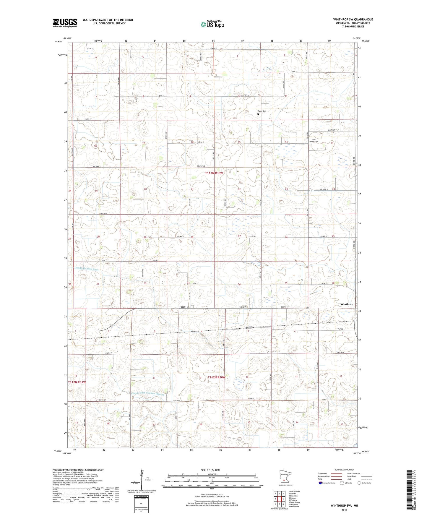
2019 topographic map quadrangle Winthrop SW in the state of Minnesota. Scale: 1:24000. Based on the newly updated USGS 7.5' US Topo map series, this map is in the following counties: Sibley. The map contains contour data, water features, and other items you are used to seeing on USGS maps, but also has updated roads and other features. This is the next generation of topographic maps. Printed on high-quality waterproof paper with UV fade-resistant inks.
Quads adjacent to this one:
West: Gibbon
Northwest: Buffalo Lake
North: Stewart
Northeast: Brownton
East: Winthrop
Southeast: Bernadotte
South: Lafayette
Southwest: Saint George
Contains the following named places: County Ditch Number Fortyfour, County Ditch Number Twentyfour, County Ditch Number Twentythree A, County Ditch Number Two, East of Gibbon Rest Area, Saint John Church, Saint John School, Saint John's Cemetery, Tabor Cemetery, Township of Bismarck