MyTopo
Brownton Minnesota US Topo Map
Couldn't load pickup availability
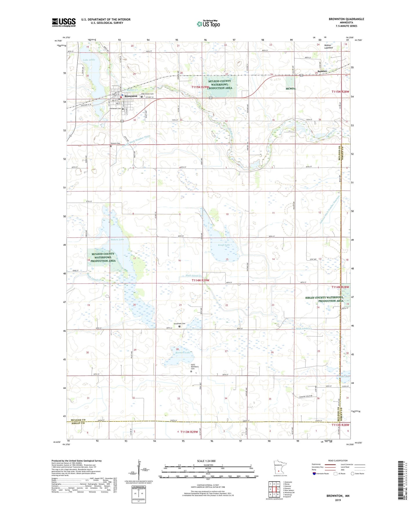
2022 topographic map quadrangle Brownton in the state of Minnesota. Scale: 1:24000. Based on the newly updated USGS 7.5' US Topo map series, this map is in the following counties: McLeod, Sibley. The map contains contour data, water features, and other items you are used to seeing on USGS maps, but also has updated roads and other features. This is the next generation of topographic maps. Printed on high-quality waterproof paper with UV fade-resistant inks.
Quads adjacent to this one:
West: Stewart
Northwest: Heatwole
North: Biscay
Northeast: Glencoe
East: New Auburn
Southeast: Gaylord
South: Winthrop
Southwest: Winthrop SW
This map covers the same area as the classic USGS quad with code o44094f3.
Contains the following named places: Bakers Lake, Bremers Lake, Brownton, Brownton Police Department, Brownton Post Office, Brownton Public Library, Brownton Volunteer Fire Department, City of Brownton, County Ditch Number Thirty, Grace Lutheran Church, Immanuel Cemetery, Immanuel Lutheran Church, Judicial Ditch Number Eighteen, Kings Lake, Lake Addie, Lewis Lake, McLeod West Senior High School, Mud Lake, Oak Grove Cemetery, Penn State Wildlife Management Area, Saint Matthew's Cemetery, Saint Matthews Church, Shade Tree Retirement Center, Spiering State Wildlife Management Area, Streich Cemetery, Sumter, Sumter Post Office, Township of Penn, ZIP Code: 55312