
MyTopo
Black Hawk Mississippi US Topo Map
Couldn't load pickup availability
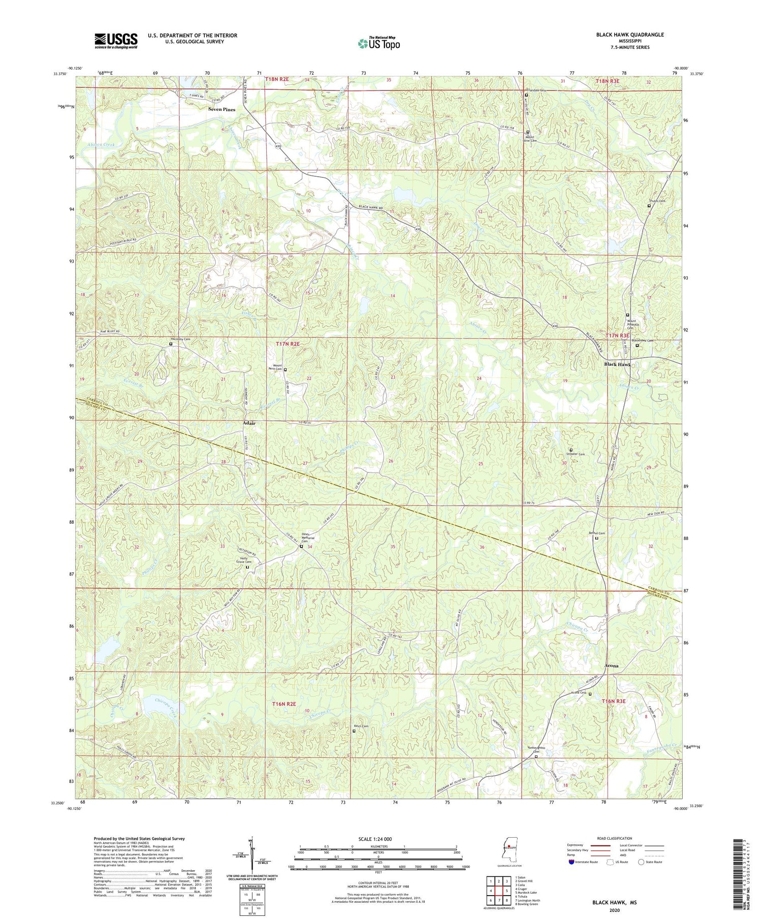
2020 topographic map quadrangle Black Hawk in the state of Mississippi. Scale: 1:24000. Based on the newly updated USGS 7.5' US Topo map series, this map is in the following counties: Holmes, Carroll. The map contains contour data, water features, and other items you are used to seeing on USGS maps, but also has updated roads and other features. This is the next generation of topographic maps. Printed on high-quality waterproof paper with UV fade-resistant inks.
Quads adjacent to this one:
West: Cruger
Northwest: Sidon
North: Gravel Hill
Northeast: Coila
East: Murdock Lake
Southeast: Bowling Green
South: Lexington North
Southwest: Tchula
Contains the following named places: Abiaca Watershed Y-34-10 Dam, Abiaca Watershed Y-34-2 Dam, Abiaca Watershed Y-34-21 Dam, Abiaca Watershed Y-34-23 Dam, Abiaca Watershed Y-34-25 Dam, Abiaca Watershed Y-34-28 Dam, Abiaca Watershed Y-34-29 Dam, Abiaca Watershed Y-34-36 Dam, Abiaca Watershed Y-34-38 Dam, Abiaca Watershed Y-34-43 Dam, Abiaca Watershed Y-34-7 Dam, Acona, Acona Methodist Cemetery, Adair, Bethel Christian Methodist Episcopal Cemetery, Bethel Church, Black Hawk, Black Hawk Church, Black Watershed Y-36-53 Dam, Black Watershed Y-36-54 Dam, Blackhawk Cemetery, Coila Creek, Dry Creek, Ellandale Cemetery, Ellandale Church, Harmony Baptist Church, Harmony Cemetery, Hines Memorial Cemetery, Holly Grove Cemetery, Holly Grove Church, Holly Grove School, Keirn Cemetery, Mount Olive Cemetery, Mount Olive Church, Mount Pera Cemetery, Mount Pera Church, Mount Pleasant Cemetery, Mount Pleasant Church, Oak Grove School, Oklahoma Church, Phillips Creek, Seven Pines, Shute Cemetery, Stanton Brothers Lake Dam, Steal Chapel, Streater Cemetery, Supervisor District 3, Union Church, Vanhoughton Cemetery


