MyTopo
Bowling Green Mississippi US Topo Map
Couldn't load pickup availability
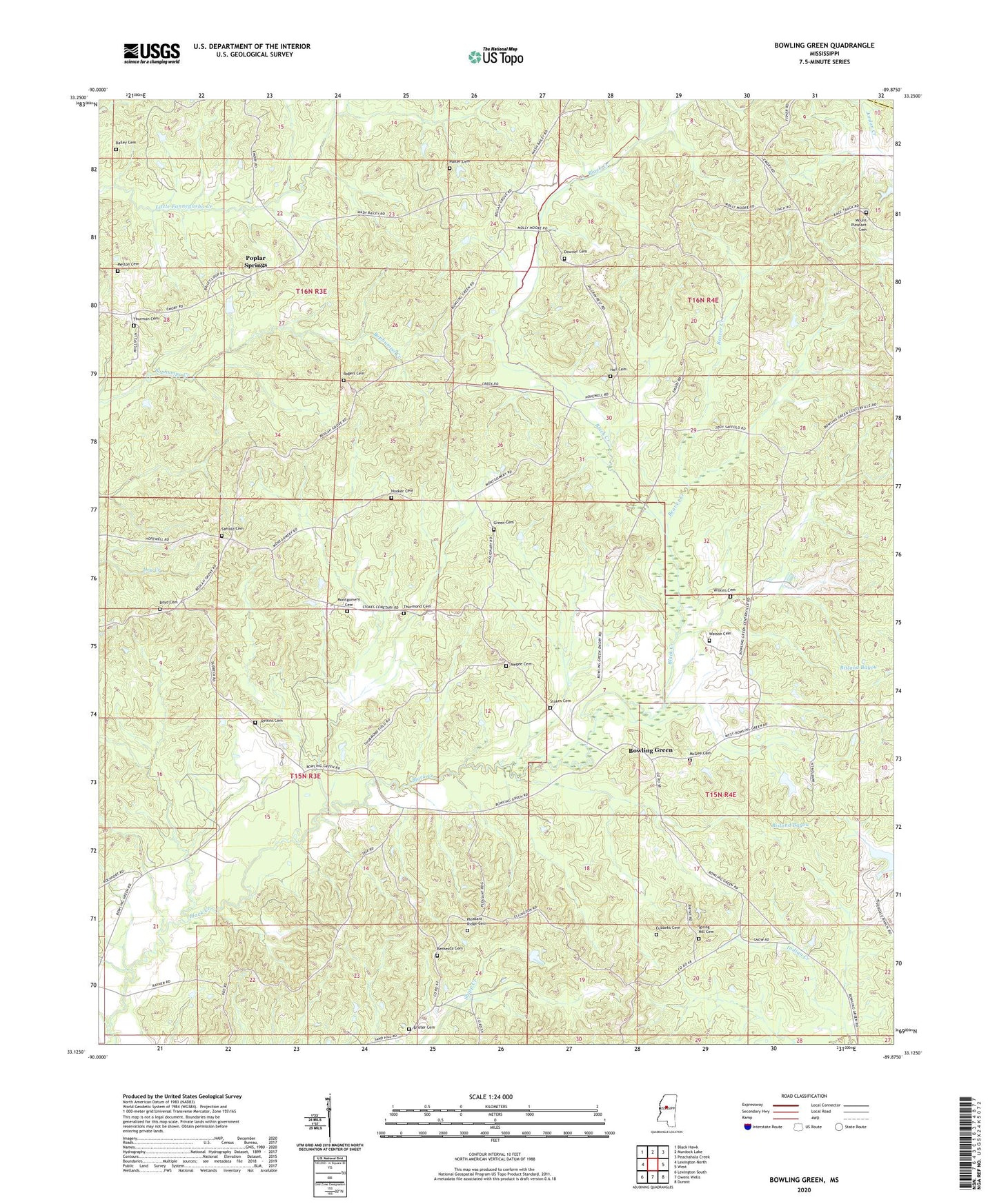
2020 topographic map quadrangle Bowling Green in the state of Mississippi. Scale: 1:24000. Based on the newly updated USGS 7.5' US Topo map series, this map is in the following counties: Holmes, Carroll. The map contains contour data, water features, and other items you are used to seeing on USGS maps, but also has updated roads and other features. This is the next generation of topographic maps. Printed on high-quality waterproof paper with UV fade-resistant inks.
Quads adjacent to this one:
West: Lexington North
Northwest: Black Hawk
North: Murdock Lake
Northeast: Peachahala Creek
East: West
Southeast: Durant
South: Owens Wells
Southwest: Lexington South
Contains the following named places: Bailey Cemetery, Beaver Creek, Bethesda Cemetery, Bethesda Chapel, Bowling Green, Boyd Cemetery, Brister Cemetery, Downer Cemetery, Eubanks Cemetery, First Pilgrim Rest Church, Green Cemetery, Hall Cemetery, Hooker Cemetery, Hopewell Church, Jenkins Cemetery, Lindsey Lake Dam, Lower Shady Grove Church, McGee Cemetery, Megee Cemetery, Melton Cemetery, Montgomery Cemetery, Mount Pleasant Cemetery, Mount Pleasant Church, Pleasant Ridge Cemetery, Pleasant Ridge Church, Poplar Springs, Porter Cemetery, Rogers Cemetery, Saffold Cemetery, Spring Hill Cemetery, Stokes Cemetery, Thurman Cemetery, Thurmond Cemetery, Upper Shady Grove Church, Watson Cemetery, Wilkins Cemetery