MyTopo
West Mississippi US Topo Map
Couldn't load pickup availability
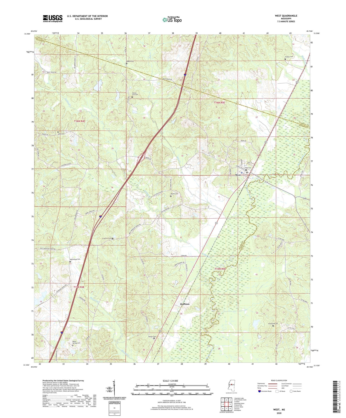
2024 topographic map quadrangle West in the state of Mississippi. Scale: 1:24000. Based on the newly updated USGS 7.5' US Topo map series, this map is in the following counties: Holmes, Attala, Carroll. The map contains contour data, water features, and other items you are used to seeing on USGS maps, but also has updated roads and other features. This is the next generation of topographic maps. Printed on high-quality waterproof paper with UV fade-resistant inks.
Quads adjacent to this one:
West: Bowling Green
Northwest: Murdock Lake
North: Peachahala Creek
Northeast: Vaiden
East: Hesterville
Southeast: McAdams
South: Durant
Southwest: Owens Wells
This map covers the same area as the classic USGS quad with code o33089b7.
Contains the following named places: Armstrong Cemetery, Bagley Cemetery, Brister Cemetery, County Line Cemetery, Crawford Cemetery, D C Obraint Dam, Edsville, Friendship Church, Hoffman, Hudson Cemetery, Hudson Church, Jordan Creek, Kyle Creek, Liberty Hill Church, Long Branch Church, Moorehead Cemetery, Mount Vernon Church, New Hope Church, Old County Line Church, Riverside Farm Dam, Rockport, Rocky Springs Cemetery, Rocky Springs Church, Saint Joseph Church, Supervisor District 2, Town of West, Weeks, West, West Cemetery, West Police Department, West Post Office, Whelin Cemetery, Wilks Cemetery, ZIP Code: 39192