MyTopo
Peachahala Creek Mississippi US Topo Map
Couldn't load pickup availability
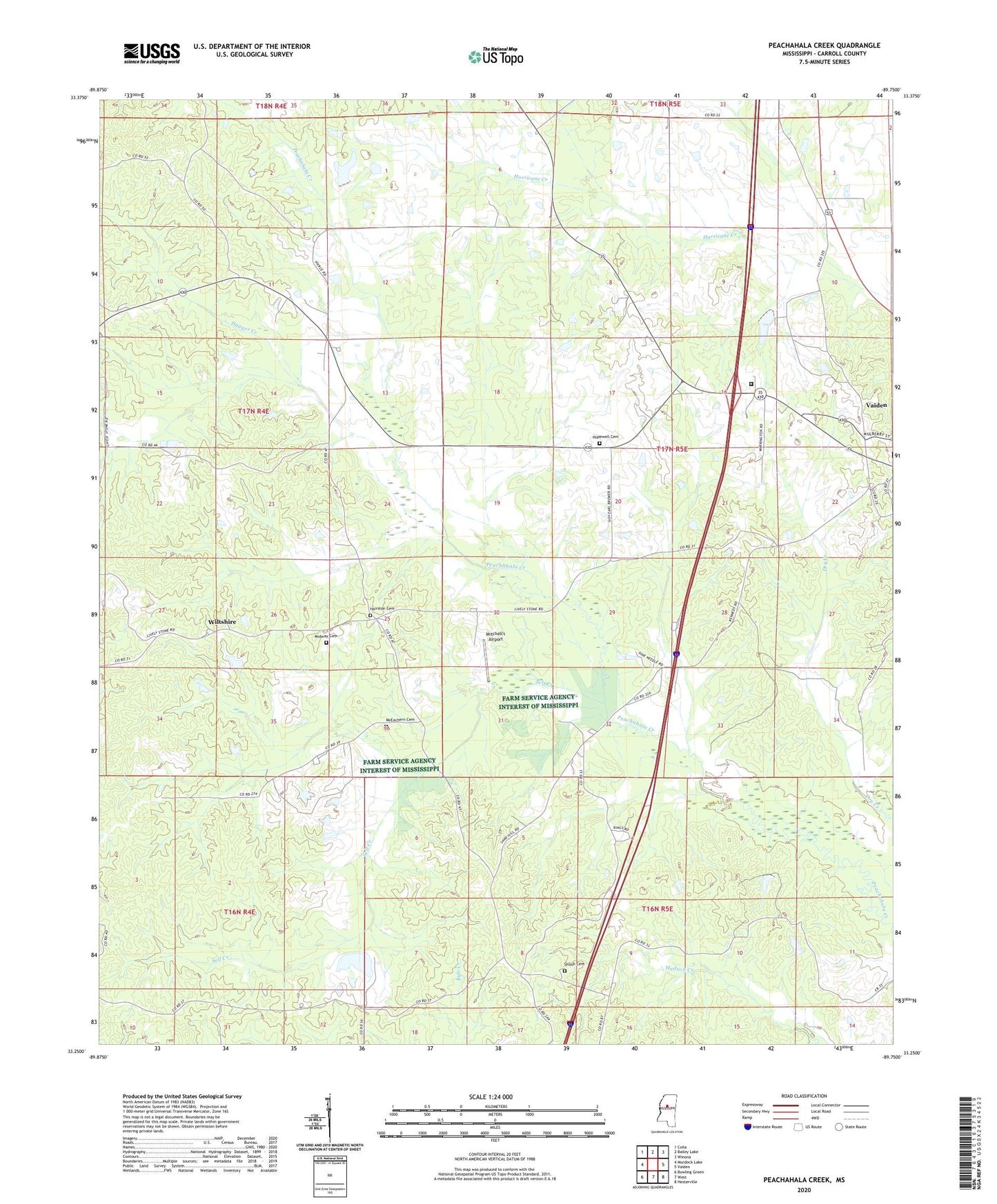
2024 topographic map quadrangle Peachahala Creek in the state of Mississippi. Scale: 1:24000. Based on the newly updated USGS 7.5' US Topo map series, this map is in the following counties: Carroll. The map contains contour data, water features, and other items you are used to seeing on USGS maps, but also has updated roads and other features. This is the next generation of topographic maps. Printed on high-quality waterproof paper with UV fade-resistant inks.
Quads adjacent to this one:
West: Murdock Lake
Northwest: Coila
North: Bailey Lake
Northeast: Winona
East: Vaiden
Southeast: Hesterville
South: West
Southwest: Bowling Green
This map covers the same area as the classic USGS quad with code o33089c7.
Contains the following named places: Carroll - Montgomery County / Regional Correctional Facility, Hagger Creek, Hairston Cemetery, Hopewell Cemetery, Lively Stone Church, McEachern Cemetery, Midway Cemetery, Midway Church, Mitchell's Airport, Mount Zion Church, Self Creek, Shiloh Cemetery, Shiloh Church, Shongalo, Supervisor District 5, Town of Vaiden, Wiltshire, ZIP Code: 39176