MyTopo
Boyer Mississippi US Topo Map
Couldn't load pickup availability
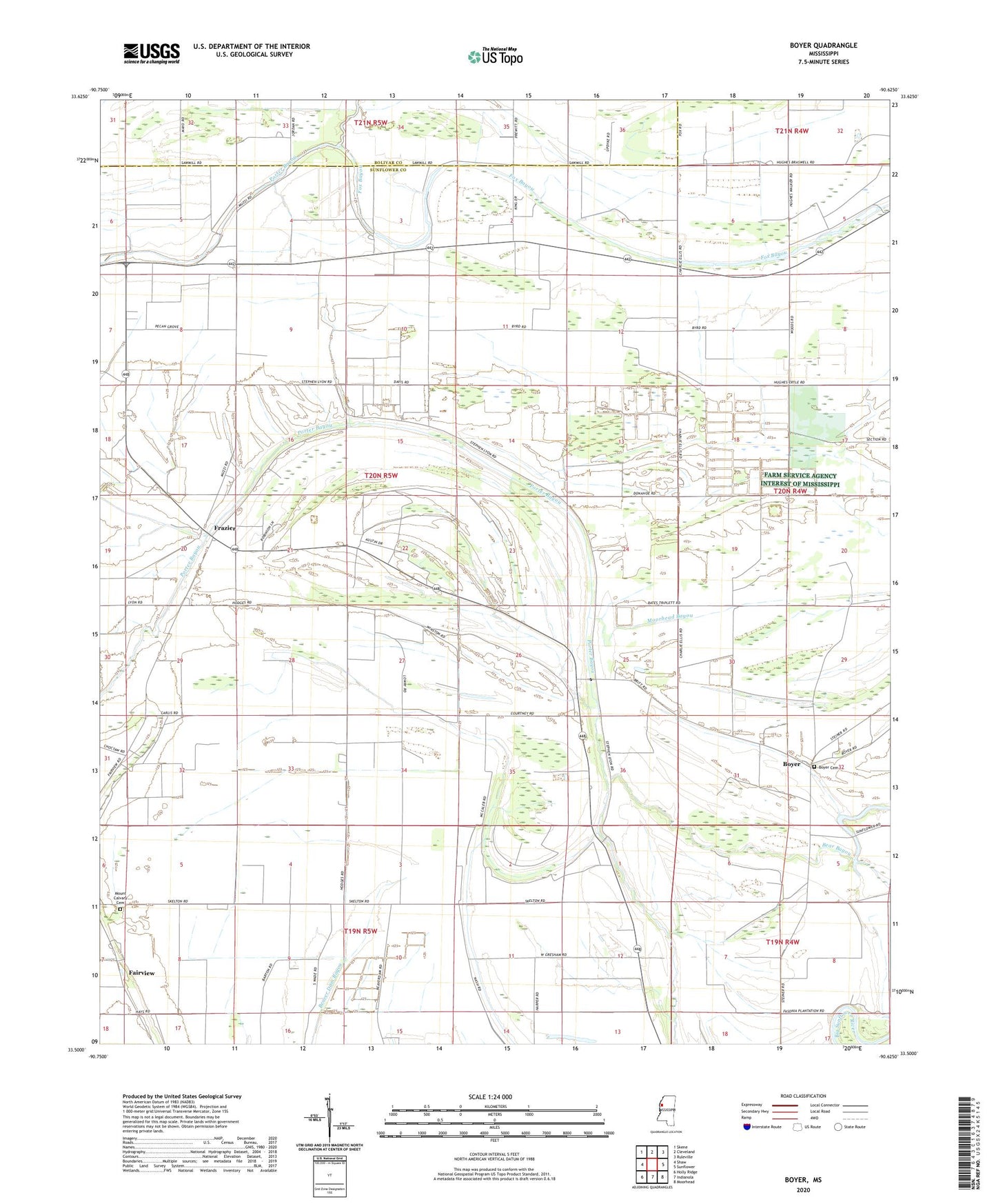
2020 topographic map quadrangle Boyer in the state of Mississippi. Scale: 1:24000. Based on the newly updated USGS 7.5' US Topo map series, this map is in the following counties: Sunflower, Bolivar. The map contains contour data, water features, and other items you are used to seeing on USGS maps, but also has updated roads and other features. This is the next generation of topographic maps. Printed on high-quality waterproof paper with UV fade-resistant inks.
Quads adjacent to this one:
West: Shaw
Northwest: Skene
North: Cleveland
Northeast: Ruleville
East: Sunflower
Southeast: Moorhead
South: Indianola
Southwest: Holly Ridge
Contains the following named places: A E Britt Pond Dam, Bishop Pond Dam, Boyer, Boyer Cemetery, Charles Ellis Pond Dam, Christian Church, Church of God, Cottonwing Airport, Fairview, Fairview Methodist Church, Fairview School, Faisonia, Fox Bayou, Frazier, Hale School, Holly Grove Church, Keller School, Lakeside Plantation, Macedonia Church, Macedonia School, Marie School, Moorhead Bayou, Mount Aver Church, Mount Calvary Cemetery, Mount Calvary Church, Mount Olive Church, Mount Olive Hale Church, Mount Olive School, Mount Zion Center Church, New Hope Church, Oak Grove Church, Oak Grove School, Pilgrim Green Church, Pilgrim Rest Church, Pleasant Grove Church, Saint Peter Church, Shackelford Lake, Spring Hill Church, Springhill School, Stephensville School, Stephenville, Tommy Ellis Lake Dam, Tommy Ellis Pond Dam, Waltonia, Waltonia School